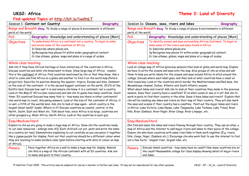

Following their personal choices in session 1, children research the countries they identified. They mark physical features on their maps, including rivers, lakes, deserts and mountains. They also identify the oceans and seas.
Suitable for years 5 and 6.
Suitable for years 5 and 6.
Something went wrong, please try again later.
A good opportunity for children to develop their map skills.
Report this resourceto let us know if it violates our terms and conditions.
Our customer service team will review your report and will be in touch.
£0.00