Resources created for an SEN group, aimed at learners with autism, mixed KS1/KS2, during an Indian topic.
Included are visual supports and structured activities.
As our topic was India with a Geography focus, the blockbuster game also includes land-form questions. Questions are very simple due to the needs of the group, questions also include questions about the identity of Jungle Book characters.
The Indian animals booklet is more of a 'tiger fact-sheet' to go with the 'Tigers' power point. I had planned to create a booklet about Indian animals but ran out of time on the topic.
Adapted and simplified story from the original Dr Seuss ‘If I ran the Rainforest’ book. Powerpoint with story and pictures.
Does not include the section on Transpiration.
Deforestation unit of work. No prep required.
Worksheets:
what is deforestation? (students match pictures to before, during and after).
Why deforestation occurs (students cut and stick to show which are natural disasters and which are human causes of deforestation).
Where is deforestation happening (map showing where forests were, and what is left- students label named areas).
How it happens (students cut and stick to show areas of deforestation caused by slash and burn or clear cutting).
Impact on different areas (students match terms and descriptions).
Reducing deforestation (students select from a choice, and are encouraged to come up with their own examples).
Revision/ Test- contains a question from each area to check understanding and to revise the topic. Choice of answers for some questions, while others need a bullet point or sentence to be written (lower abilities may need a scribe for this).
Label the 4 different layers of the Rainforest.
Match the description with the correct photo and label.
Lower abilities- cut out labels and stick in correct places.
Middle abilities- cut out photos and stick. Copy labels.
Higher abilities- cut out photos and stick. Write own labels.
Includes an extension worksheet for students to write their own descriptions of the 4 layers of the rainforest and a mapping exercise for students to find where rainforests are located around the world and colour in on the map (map be best if printed on A3).
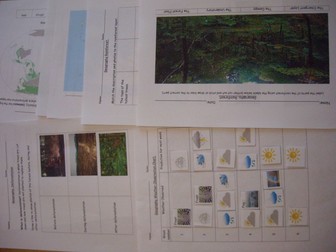
Weather
Use the chart (print in A3) to record the weather for 6 weeks in your local area, or use the 2nd chart to compare 2 places or countries. Includes 2 question worksheets for higher abilities, 1 being a recap and summary worksheet of their findings comparing 2 places/countries.
For lower ability levels- includes pictures of sunshine, clouds, snow, rain, storm, fog, frost, rainbow, and wind to help with understanding. Allows them to observe the days weather and think about what the weather will be like next week.
For higher ability levels- space to write the weather they can see and allows them to predict what they think the weather will be next week. Children could also take their own photos of the weather and stick them on the chart. A clip from BBC weather showing the latest weather forecast could be shown during the lesson, and children could be encouraged to look at different areas of the UK or another country to compare the weather in different regions. Use the 2 worksheets to compare understanding before carrying out the observations and after to check learning and understanding.
 Quick View