


This interesting and highly-stimulating lesson enables students to describe and understand the key aspects of Africa’s major rivers and lakes. Whilst gaining a wide range of knowledge about the rivers and lakes, students also become familiar with a wide range of vocabulary pertinent to the geography curriculum.
The lesson follows a clear, logical, bite-size learning journey, which guides students towards relevant and constructive learning objectives. Over the course of this journey, they become able to:
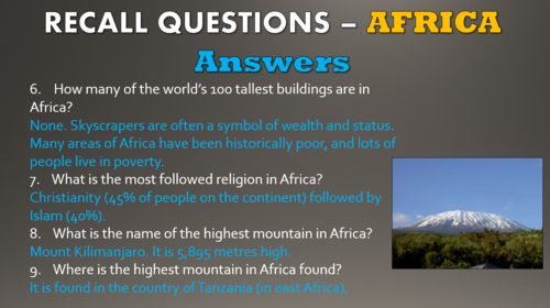
-Remember key facts about the African continent to contextualise their learning;
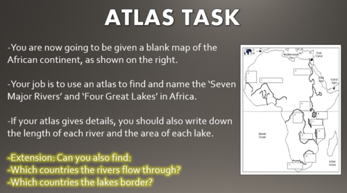
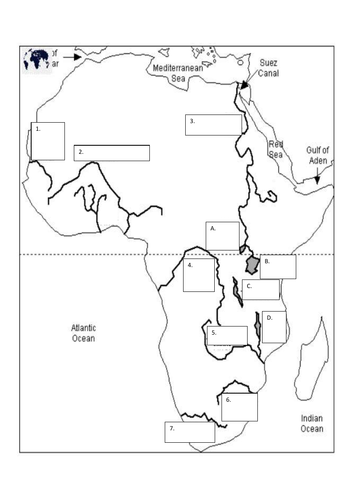
-Identify African rivers and lakes on a map, and identify the countries and regions within the continent;
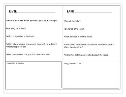
-Learn about the Nile and Lake Victoria - modelled in the presentation;
-Retrieve, share, and describe key information about various rivers and lakes in Africa, through a researching activity.
-Peer assess each others’ descriptions using the learning objectives.
The lesson requires access to atlases and/or web-searching devices.
This resource pack includes:
-A visually engaging whole-lesson PowerPoint presentation (16 slides);
-A blank map for the atlas activity;
-Research template for the main activity;
The resources within this lesson can be easily adapted to suit home/remote learning.
Get this resource as part of a bundle and save up to 61%
A bundle is a package of resources grouped together to teach a particular topic, or a series of lessons, in one place.
Something went wrong, please try again later.
This resource hasn't been reviewed yet
To ensure quality for our reviews, only customers who have purchased this resource can review it
Report this resourceto let us know if it violates our terms and conditions.
Our customer service team will review your report and will be in touch.
£2.00