

Identity
Key words
Google Earth - or consider Atlas - depending on students’ locational knowledge and skills
Video with a few comprehension questions - AFL
Images, Atlas, Split, Latitude images/ information available - explanation available if needed.
South Sudan - questions about placement etc. (in lesson plan)
Timeline reading
Mind map ideas - from timeline prompts - you may want to explain, draw etc.
I used Iraq as an example (about the war and religion) - and linking it to humanities - affecting this independence and conflict etc.
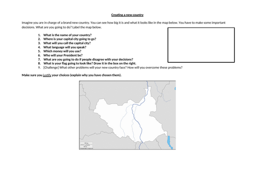
Design your own country - questions to ask to check understanding
Include prompt questions in instructions – e.g., do you want the capital city to be in the mountains or near the river? Why?/ do you want them to speak the same language or something different and why?
Questions about their new country - students to justify
They label their country
Challenges included
Random sharing - wheel of fortune included in PPT. Adjust names.
Something went wrong, please try again later.
This resource hasn't been reviewed yet
To ensure quality for our reviews, only customers who have purchased this resource can review it
Report this resourceto let us know if it violates our terms and conditions.
Our customer service team will review your report and will be in touch.
£5.00