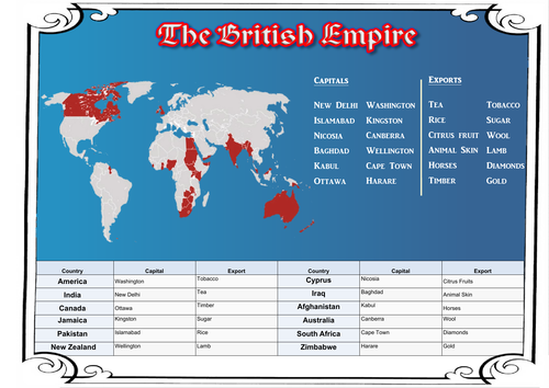

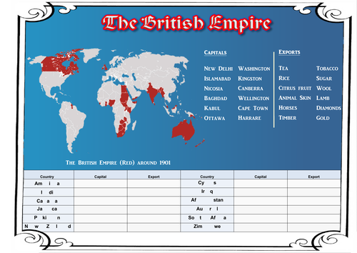
This is a worksheet used for looking at the British Empire in 1901 during the Victorian Era, showing the extent of the Empire, SOME of the countries within the Empire and SOME of those countries’ exports into Great Britain.
NOTE: Children should be taught that Pakistan was NOT a country at this point and wasn’t officially recognised as its own country until 1956. The inclusion of it is to highlight the area as being under British control as many pupils will be familiar with it in the modern sense. SOME of the smaller countries and islands are virtually impossible to see on the map due to sizing, such as Cyprus.
This resource was made during my first placement in my training year many moons ago and was an attempt to link geography with the topic of the Victorians, using an atlas and the internet after simply being told to do a ‘geography lesson about the Victorians’.
Something went wrong, please try again later.
I like the research element of the map work. Thanks
Very visual !
Report this resourceto let us know if it violates our terms and conditions.
Our customer service team will review your report and will be in touch.
£0.00