Mountain Environments is a Geography unit suitable for KS2 (Y4-6) and has everything you need for covering a mountains topic.
The planning overview, topic title page and vocabulary page can be downloaded for free here. Lessons include:
L1 – Identifying the key features of mountains
L2 – Identifying the world’s major mountain ranges
L3 – Locating the world’s famous mountains using latitude and longitude
L4 – Understanding how fold mountains are formed
L5 – Investigating the structure of a volcano (FREE)
L6 – Researching famous world mountains (FREE)
L7 – Investigating mountain climates
Each lesson includes a presentation and differentiated activities/worksheets.
If you like this resource, we would appreciate a review! We will happily send you a free resource in return for a review or useful suggestions/feedback. Contact us at ed@teachitforward.co.uk.
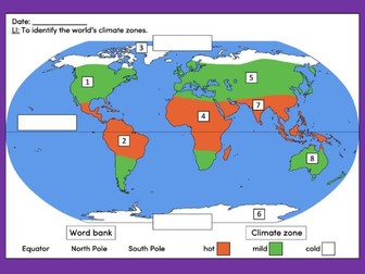
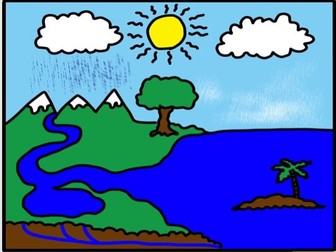
This lesson is an ideal introduction to the world’s three main climate zones.
It is part of Our World, a Geography unit designed for students in KS1 and lower KS2 (Y1-3), but can also be taught as a stand alone lesson.
First the presentation helps students understand that different places in the world have different climates. It then looks at the location of the Equator and North/South poles, and how these relate to the three main climate zones. To keep things simple, these are referred to as hot (tropical), mild (temperate) and cold (frigid).
The activity challenges students to locate the Equator and poles and then identify various climate zones around the world. It is differentiated two ways:
Easier – Students identify the climate zone of 8 numbered points around the world.
Harder – Students identify climate zone and continent of 8 numbered points around the world.
Extension – Students cut and stick pictures of four animals – elephant, lion, polar bear and penguin – onto their world climate zone map.
If you like this resource, we would appreciate a review! We will happily send you a free resource in return for a review or useful suggestions/feedback. Contact us at ed@teachitforward.co.uk.
This clear, detailed and visually-appealing resource offers a complete reference point for students revising knowledge relating to the United Kingdom, as a part of locational knowledge in geography. It contains comprehensive sections on:
Overview and map;
Counties and Cities of the UK;
Longest Rivers;
Highest Mountains;
Human Geography Features;
Physical Geography Features.
The resource is designed to be printed onto A3, and is provided as both a PDF and a Word version (so that you can edit if you want to). All images used are licensed for commercial use and are cited on a separate document (included). The resource is most suitable for students in KS2 or lower KS3.
A series of 8 lessons including worksheets, PowerPoints and website links. All resources editable. Lessons focus on the causes, impacts and prevention methods relating to various types of extreme weather. The final two lessons focus on a case study linking to the issues with flooding in Bangladesh.
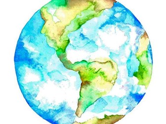
Our World is a comprehensive Geography topic about Planet Earth, suitable for KS1 and lower KS2 (Y1-3).
The planning overview, topic title page and vocabulary page can be downloaded for free here. Lessons include:
L1 – Completing a world map jigsaw
L2 – Identifying the continents and oceans of the world (FREE)
L3 – Where do we live?
L4 – Identifying human and natural features of the world
L5 – Investigating satellite photos of famous world landmarks
L6 – Introduction to compass directions
L7 – Identifying world climate zones
L8 – Identifying the countries and capitals of the UK (FREE)
Each lesson includes a presentation and differentiated activities/worksheets.
If you like this resource, we would appreciate a review! We will happily send you a free resource in return for a review or useful suggestions/feedback. Contact us at ed@teachitforward.co.uk.
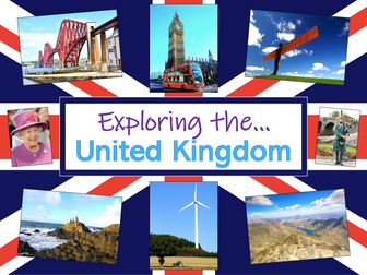
Exploring the UK is a Geography unit suitable for KS1 and lower KS2 (Y2-4).
The planning overview, topic title page and vocabulary page can be downloaded for free here. Lessons include:
L1 – Identifying the countries and capitals of the UK & Ireland (FREE)
L2 – Locating UK cities using compass directions
L3 – Identifying human & physical features of the UK
L4 – Investigating satellite photos of the UK
L5 – Comparing the city and the countryside
L6– Identifying famous features and characteristics of countries of the UK
L7 – Identifying flags of the United Kingdom
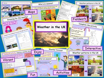
L8 – Identifying the four seasons of weather in the UK
Optional lesson – Identifying the countries and capital cities of Europe
Each lesson includes a presentation and differentiated activities/worksheets.
If you like this resource, we would appreciate a review! We will happily send you a free resource in return for a review or useful suggestions/feedback. Contact us at ed@teachitforward.co.uk.
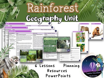
Enhance your Key Stage 2 curriculum with our outstanding Rainforest Unit - a comprehensive set of six engaging geography lessons meticulously designed to foster an in-depth understanding of rainforests. This resource is a valuable addition to your teaching toolkit, complete with detailed lesson plans, informative PowerPoints, and student-focused worksheets.
Lesson 1: Rainforest Regions and Significance
In this lesson, students will identify the continents hosting rainforests, label a world map with major rainforest regions, and grasp the significance of rainforests for Earth’s biodiversity. The lesson starts with an intriguing Rainforest Wonder Box activity, setting the tone for exploration.
Lesson 2: Rainforest Climate and Adaptations
Students will explore the climate characteristics of rainforests, understand why they are called “rainforests,” and identify adaptations of animals and plants. The lesson fosters critical thinking and understanding of how species thrive in rainforest conditions.
Lesson 3: Layers of the Rainforest
This lesson delves into the various layers of the rainforest, highlighting the unique organisms that inhabit each layer. Students will create engaging visual representations of rainforest layers, enhancing their knowledge of the intricate ecosystems.
Lesson 4: Rainforest Animals and Plants
Students will categorize and differentiate between rainforest animals and plants, gaining insights into the rich diversity of rainforest life. Engaging activities, including “Categorising Organisms” and “Rainforest Habitat Diorama,” deepen their comprehension.
Lesson 5: Amazon Rainforest vs. UK Forest
Comparing the Amazon rainforest and a UK forest, students will identify differences and similarities, understand biodiversity, and explore the importance of these ecosystems. The lesson encourages critical thinking and insightful discussions.
Lesson 6: Rainforest Conservation and Action
In the final lesson, students will comprehend the significance of rainforest conservation and discover ways to contribute. Engaging activities like creating conservation posters or slogans empower students to express their commitment to preserving these vital environments.
Our unit equips educators with everything needed for an engaging rainforest unit, including PowerPoint presentations, visual aids, worksheets, and hands-on activities. Promote geographical understanding, critical thinking, and environmental awareness with our Rainforest Unit.
Have any issues with this resource or a request? Contact us directly for the quickest response at: explore_education@outlook.com
Tags: Key Stage 2, Geography, Rainforest, Biodiversity, Conservation, Ecosystem, Climate, Adaptations, Critical Thinking, Interactive, Engaging, Curriculum, Lesson Plans, PowerPoints, Worksheets, interview, ofsted, observation
Europe plan
8 lesson plan that focuses on a range of topics related to Europe.
Lesson 1 - What is Europe like?
Lesson 2 - Countries in Europe
Lesson 3 - Fact file on a country in Europe
Lesson 4 - Capital cities
Lesson 5 - Population and currency
Lesson 6 - Temperature
Lesson 7 - Mountains in Europe
Lesson 8 - Landmarks (persuasive writing)
Initially planned for Year 4 but could be adapted for other year groups.
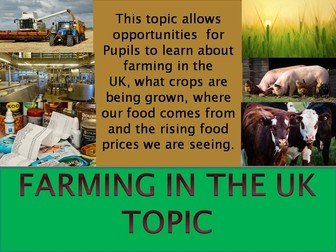
A grow your own topic - A topic has been written for parents who home school and teachers who would like a fun topic that offers opportunities for children and pupils to choose what fruit and vegetables they would like to grow in their home garden or school garden. Through research choose the vegetables they would like to eat later in the year.
Parents and teachers can use the websites listed to help in their ’ grow your own ’ topic and through this, offers many opportunities to spend time outdoors preparing an area of the garden for growing crops. My two and half year old enjoyed placing the pea seeds in the seed trays indoors ready in a few weeks to plant the seedlings outdoors. All children will enjoy being involved in the sewing of the seeds, to eventually harvesting the crops to enjoy and eat.
Additional activities for older children allows further research to be carried out online: To transfer the data collected onto maps
produce posters on what is needed to be successful at growing vegetables or fruits, thinking about what tools are needed and the time of year the seeds will be planted.
A storyboard/ time board activity to draw the process of preparing the veg patch, planting the seeds indoors, watering, planting out the seedlings outside to how long it takes the vegetables to grow. (Those children who love drawing can draw further detailed drawings of the vegetables)
Enjoy and have fun spending time outdoors in this topic.
L 1 Geography - Seasons - Understand and gain knowledge on impact of seasonality on food production around the world.
By the end of the lesson children would be able to: summarise and give an explanation why foods are grown in seasons.
Identify the climates and locations where food is grown, reared, caught and produced.
To locate where food is exported in the world.
L 1 & L 2 Farm to Fork lessons Include: lesson plans, PPP , resources and weblinks including an opportunity for Children to interview a local farmer as well as watch the BBC programme – Jimmy’s Farm Heroes 2008 (1 hour in length), making notes about what is affecting today’s farmers the most.
Children in Lesson 1 will compose questions to ask a farmer and interpret his/her answers
In Lesson 2 children will understand the link between land use and economic activity.
By the end of lesson 1 children will be able to ask open ended questions.
Interpret information from different sources and evaluate, from interviewing, that there are physical and human characteristics that affect farming.
By the end of lesson 2 children will successfully identify land use; Identify the effect of land use on economic activity. As well as identify the distribution of food from its origin.
Included is a photo of some notes the class teacher took when interviewing a local Cornish Farmer.
L 3 Farm to Fork This Geography lesson follows on from \farm to Fork L1 & L2 and gives opportunities for researching different types of farming, expressing views and opinions on farming and how food ends up on our plates. Answering questions: do you know where our food comes from? As a nation should we be supporting our local farmers?
There are links to a number of numeracy lessons on how far food travels from farms to end up on the supermarket shelves. Websites provide information on locations of locally sourced food products, and who these farmers sell their produce to. It is not just dairy, rearing animals, crop growing; fishermen are also farmers, catching fish to sell at markets and restaurants.
This lesson provides opportunities for discussion on farming life and the produce that is sold to supermarkets and other sources for profit.
L 4 Geography/History – Changes in our landscapes
Topic day- Methods of farming and changing land use.
This lesson entails using search technologies effectively, appreciate how results are selected and ranked and be discerning in evaluating digital content.
To use technology safely, respectfully and responsibly.
Q. How has methods of farming and land use changed over time?
To gain an understanding of how land use and life has changed over time and recognise key topographical features using and reading OS maps identifying land use symbols and scales as well as locations and distances on all scales of maps, including national and world maps.
This lesson is for upper KS2 and is an ideal lesson for a topic day where pupils would be looking into farming and land use seeing how much has changed over time.
Pupils would use local maps of a county, regional and nationally from a local library - to see how land use has changed over a period of time in the history aspect of this lesson.
With a focus on the different farming ways –studying beef, sheep, dairy, arable, mixed, pastoral and renewable energy using Google Earth as a source of information.
The aim of the geography lesson is for pupils to consider the changes that can happen in an area and about the impact that these changes can have on both the environment and the people who live there.
L 5 Opportunities to research where farms are locally; also finding out what produce is farmed and do these farms supply supermarkets?
Pupils can also use the links provided to help them research crop and animal production from the different farms in the UK-
Using the map pupils can work out the scale – distances in miles/km, then work out the time it would take to transport/deliver the produce to its destination, including counties/countries travelled through.
The lesson gives pupils opportunities to research using the world wide web and ways of how they will present their findings from their research.
L 6 This lesson has a scientific aspect, giving pupils a chance to understand and research what foods are consumed in the world and how they are consumed.
What foods are produced for the fast food industry and how does overconsumption of certain foods increase obesity in the world?
Pupils will have opportunities to research areas of the world where there is an obesity crisis; also by watching a bbc clip/you tube clip –‘The men who made us fat’. Will allow pupils to think about the foods we eat, seeing fast food restaurants everywhere, and advertisements.
By researching the crops that are grown and farmed in the world have a huge impact on world population and world obesity.
L 8 Food distribution is a current issue as is food production; this lesson is about both these issues. Children will consider both and investigate what foods are grown, produced and distributed in the UK; the impact farmers are facing with costs and profits when supplying their produce to supermarkets. Children will have opportunities in mapping food production and distribution in the Great Britain and around the world, and write a report on why there is so much food waste from vegetables grown as they don’t match the supermarkets criteria in size and shape.
L 10 This lesson will give pupils an understanding of the concept of varying food prices across the supermarkets. As well as opportunities for research and give an explanation of varying food prices across the UK and world.
When we do our food shopping, do you look at the prices between supermarkets on certain produce?
Today’s lesson involves thinking about
Q. Why does the cost of fruit and vegetables vary so much between the supermarkets?
Many food produce, especially fruit and vegetables are imported from around the world.
Q. How does this impact and influence the shopper on food prices?
As a nation are we set in our ways in only buying from one supermarket, or only buying brand name produce?
A research lesson where children will evaluate their findings, putting the data collected into a graph and writing an explanation of what has been found out.
This clear, detailed and visually-appealing resource offers a complete reference point for students revising knowledge relating to Antarctica, as a part of their study of physical and human geography. It contains comprehensive sections on:
Overview and Map;
Areas and Territories of Antarctica;
Longest Rivers;
Highest Mountains;
Human Geography Features;
Physical Geography Features.
The resource is designed to be printed onto A3, and is provided as both a PDF and a Word version (so that you can edit if you want to). All images used are licensed for commercial use and are cited on a separate document (included). The resource is most suitable for students in KS2 or KS3.
Exploring St Lucia is a Geography unit designed for students in KS2.
As a tropical island in the Caribbean, St Lucia is great for teaching about a contrasting non-European country.
The planning overview, topic title page and vocabulary page can be downloaded for free here. Lessons include:
L1 – Locating St Lucia in the Caribbean
L2 – Identifying the human and physical features of St Lucia
L3 – Investigating satellite photos of St Lucia
L4 – Using compass directions to locate places in St Lucia
L5 – Comparing the weather of St Lucia and the UK
L6 – Comparing St Lucia with the UK
Each lesson includes a presentation and differentiated activities/worksheets.
If you like this resource, we would appreciate a review! We will happily send you a free resource in return for a review or useful suggestions/feedback. Contact us at ed@teachitforward.co.uk.
These clear, detailed and visually-appealing resources help to detail and categorise the EYFS foundation learning in each of the primary curriculum subject areas
It is an important resource for EYFS teachers and parents, but also subject leaders, to aid them in the development of a clearly-mapped and well-sequenced subject curriculum across the school.
This organiser groups the subject-related learning into the relevant EYFS areas of learning (e.g. Understanding the World, Expressive Arts and Design, Communication and Language, etc.)
The resources are designed to be printed onto A3, and are provided as both PDF and Word documents (so that you can edit if you want to). All images used are licensed for commercial use and are cited on a separate document (included).
Different Types of Holidays
Once the children have matched the correct type of holiday to the correct heading, they must decide which items to pack in their suitcase. E.g, what type of clothes would be needed for a skiing holiday?
Ideal for KS1 or KS2.
Fully editable.
This clear, detailed and visually-appealing resource offers a complete reference point for students revising knowledge relating to Australia, as a part of their study of physical and human geography. It contains comprehensive sections on:
Overview and map;
Regions and Countries of Australia;
Longest Rivers;
Highest Mountains;
Human Geography Features;
Physical Geography Features.
The resource is designed to be printed onto A3, and is provided as both a PDF and a Word version (so that you can edit if you want to). All images used are licensed for commercial use and are cited on a separate document (included). The resource is most suitable for students in KS2 or KS3.
Excellent template to help children sum up their understanding about the country they are studying. Can be used in combination to the “Travel Poster”, to the “Postcard template”, to the “country research sheet” as well as with all the resources in the “Let’s visit…!” series, all available on the Global Education Leaders shop.
Water Quiz for Early years Power Point
Simple interactive quiz for Early years.
It is good for provocation of science about water.
Use on slide show mode and click where you can find water.
sea
cloud
rain
snow
river
mist
groundwater
in the tree
lake
Works great on Interactive white board.
 Quick View