Mountain Environments is a Geography unit suitable for KS2 (Y4-6) and has everything you need for covering a mountains topic.
The planning overview, topic title page and vocabulary page can be downloaded for free here. Lessons include:
L1 – Identifying the key features of mountains
L2 – Identifying the world’s major mountain ranges
L3 – Locating the world’s famous mountains using latitude and longitude
L4 – Understanding how fold mountains are formed
L5 – Investigating the structure of a volcano (FREE)
L6 – Researching famous world mountains (FREE)
L7 – Investigating mountain climates
Each lesson includes a presentation and differentiated activities/worksheets.
If you like this resource, we would appreciate a review! We will happily send you a free resource in return for a review or useful suggestions/feedback. Contact us at ed@teachitforward.co.uk.
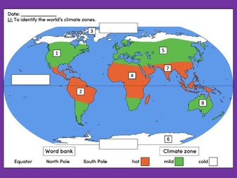
This lesson is an ideal introduction to the world’s three main climate zones.
It is part of Our World, a Geography unit designed for students in KS1 and lower KS2 (Y1-3), but can also be taught as a stand alone lesson.
First the presentation helps students understand that different places in the world have different climates. It then looks at the location of the Equator and North/South poles, and how these relate to the three main climate zones. To keep things simple, these are referred to as hot (tropical), mild (temperate) and cold (frigid).
The activity challenges students to locate the Equator and poles and then identify various climate zones around the world. It is differentiated two ways:
Easier – Students identify the climate zone of 8 numbered points around the world.
Harder – Students identify climate zone and continent of 8 numbered points around the world.
Extension – Students cut and stick pictures of four animals – elephant, lion, polar bear and penguin – onto their world climate zone map.
If you like this resource, we would appreciate a review! We will happily send you a free resource in return for a review or useful suggestions/feedback. Contact us at ed@teachitforward.co.uk.
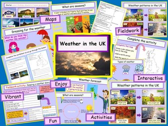
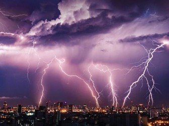
A series of 8 lessons including worksheets, PowerPoints and website links. All resources editable. Lessons focus on the causes, impacts and prevention methods relating to various types of extreme weather. The final two lessons focus on a case study linking to the issues with flooding in Bangladesh.
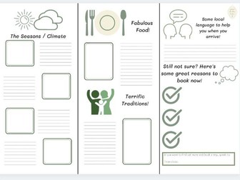
Excellent template to help children sum up their understanding about the country they are studying. Can be used in combination to the “Travel Poster”, to the “Postcard template”, to the “country research sheet” as well as with all the resources in the “Let’s visit…!” series, all available on the Global Education Leaders shop.
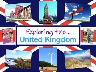
Exploring the UK is a Geography unit suitable for KS1 and lower KS2 (Y2-4).
The planning overview, topic title page and vocabulary page can be downloaded for free here. Lessons include:
L1 – Identifying the countries and capitals of the UK & Ireland (FREE)
L2 – Locating UK cities using compass directions
L3 – Identifying human & physical features of the UK
L4 – Investigating satellite photos of the UK
L5 – Comparing the city and the countryside
L6– Identifying famous features and characteristics of countries of the UK
L7 – Identifying flags of the United Kingdom
L8 – Identifying the four seasons of weather in the UK
Optional lesson – Identifying the countries and capital cities of Europe
Each lesson includes a presentation and differentiated activities/worksheets.
If you like this resource, we would appreciate a review! We will happily send you a free resource in return for a review or useful suggestions/feedback. Contact us at ed@teachitforward.co.uk.
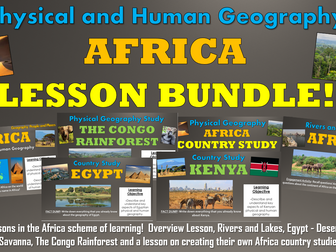
These interesting and highly-stimulating lessons enable students to develop an in-depth understanding of the physical and human geography features of the African continent. It culminates with them creating their very own African country geography study presentations. The scheme promotes engagement with varied geographical concepts including biomes, population, rivers, lakes, mountains, climate, borders and capital cities.
The lessons included are:
1.African Overview - Facts and Key Information
2.African Rivers and Lakes
3.Country Study - Egypt (inc. Sahara Desert)
4.Country Study - Kenya (inc. the Savanna)
5.The Congo Rainforest
6.Creating Country Studies
Each lesson contains eye-catching and comprehensive presentations, in addition to all of the worksheets and activity templates needed. Some of the lessons benefit from access to atlases and/or web-searching devices.
The scheme is most fitting for children across Key Stage 2.
The resources within this lesson can be easily adapted to suit home/remote learning.
This clear, detailed and visually-appealing resource offers a complete reference point for students revising knowledge relating to the United Kingdom, as a part of locational knowledge in geography. It contains comprehensive sections on:
Overview and map;
Counties and Cities of the UK;
Longest Rivers;
Highest Mountains;
Human Geography Features;
Physical Geography Features.
The resource is designed to be printed onto A3, and is provided as both a PDF and a Word version (so that you can edit if you want to). All images used are licensed for commercial use and are cited on a separate document (included). The resource is most suitable for students in KS2 or lower KS3.
This interesting and highly-stimulating lesson enables students to describe and understand the key aspects of physical geography (e.g. climates, vegetation belts, flora, fauna, mountains, and rivers) and human geography (e.g. types of settlement, populations, use of resources, and trade) in the vast and varied continent of Asia. Whilst gaining a wide range of knowledge about the content, students also become familiar with a wide range of vocabulary pertinent to the geography curriculum.
The lesson follows a clear, logical, bite-size learning journey, which guides students towards relevant and constructive learning objectives. Over the course of this journey, they become able to:
- Identify Asia on a map, and identify the countries and regions within Asia;
- Understand key information about the physical and human geography of the continent, through a fun, interactive quiz;
- Retrieve, share, and describe their understanding of the physical and human geography of specific locations in Asia (Dubai, Yala National Park, Gobi Desert, and Tokyo) through a jigsaw model task;
- Complete a case study of the physical and human geography of their own place in Asia, and describe their findings to others;
-Peer assess each other’s descriptions using the learning objectives.
This resource pack includes:
- A visually engaging whole-lesson PowerPoint presentation;
- Key case-study information sheets on Dubai, the Gobi Desert, Yala National Park and Tokyo;
- A blank case study template;
- A detailed lesson plan, complete with what the teacher and students should aim to achieve at each stage of the lesson.
All images are licensed for commercial use, and are cited on the final slide of the PowerPoint. Note: The final task works best with access to ICT/internet resources.
This clear, detailed and visually-appealing resource offers a complete reference point for students revising knowledge relating to North America, as a part of their study of physical and human geography. It contains comprehensive sections on:
Overview and map;
Regions and Countries of North America;
Longest Rivers;
Highest Mountains;
Human Geography Features;
Physical Geography Features.
The resource is designed to be printed onto A3, and is provided as both a PDF and a Word version (so that you can edit if you want to). All images used are licensed for commercial use and are cited on a separate document (included). The resource is most suitable for students in KS2 or KS3.
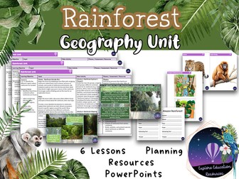
Enhance your Key Stage 2 curriculum with our outstanding Rainforest Unit - a comprehensive set of six engaging geography lessons meticulously designed to foster an in-depth understanding of rainforests. This resource is a valuable addition to your teaching toolkit, complete with detailed lesson plans, informative PowerPoints, and student-focused worksheets.
Lesson 1: Rainforest Regions and Significance
In this lesson, students will identify the continents hosting rainforests, label a world map with major rainforest regions, and grasp the significance of rainforests for Earth’s biodiversity. The lesson starts with an intriguing Rainforest Wonder Box activity, setting the tone for exploration.
Lesson 2: Rainforest Climate and Adaptations
Students will explore the climate characteristics of rainforests, understand why they are called “rainforests,” and identify adaptations of animals and plants. The lesson fosters critical thinking and understanding of how species thrive in rainforest conditions.
Lesson 3: Layers of the Rainforest
This lesson delves into the various layers of the rainforest, highlighting the unique organisms that inhabit each layer. Students will create engaging visual representations of rainforest layers, enhancing their knowledge of the intricate ecosystems.
Lesson 4: Rainforest Animals and Plants
Students will categorize and differentiate between rainforest animals and plants, gaining insights into the rich diversity of rainforest life. Engaging activities, including “Categorising Organisms” and “Rainforest Habitat Diorama,” deepen their comprehension.
Lesson 5: Amazon Rainforest vs. UK Forest
Comparing the Amazon rainforest and a UK forest, students will identify differences and similarities, understand biodiversity, and explore the importance of these ecosystems. The lesson encourages critical thinking and insightful discussions.
Lesson 6: Rainforest Conservation and Action
In the final lesson, students will comprehend the significance of rainforest conservation and discover ways to contribute. Engaging activities like creating conservation posters or slogans empower students to express their commitment to preserving these vital environments.
Our unit equips educators with everything needed for an engaging rainforest unit, including PowerPoint presentations, visual aids, worksheets, and hands-on activities. Promote geographical understanding, critical thinking, and environmental awareness with our Rainforest Unit.
Have any issues with this resource or a request? Contact us directly for the quickest response at: explore_education@outlook.com
Tags: Key Stage 2, Geography, Rainforest, Biodiversity, Conservation, Ecosystem, Climate, Adaptations, Critical Thinking, Interactive, Engaging, Curriculum, Lesson Plans, PowerPoints, Worksheets, interview, ofsted, observation
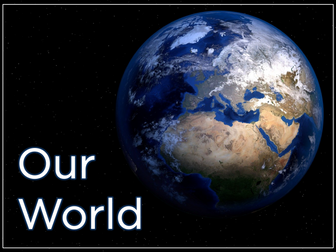
Our World is a comprehensive Geography topic about Planet Earth, suitable for KS1 and lower KS2 (Y1-3).
The planning overview, topic title page and vocabulary page can be downloaded for free here. Lessons include:
L1 – Completing a world map jigsaw
L2 – Identifying the continents and oceans of the world (FREE)
L3 – Where do we live?
L4 – Identifying human and natural features of the world
L5 – Investigating satellite photos of famous world landmarks
L6 – Introduction to compass directions
L7 – Identifying world climate zones
L8 – Identifying the countries and capitals of the UK (FREE)
Each lesson includes a presentation and differentiated activities/worksheets.
If you like this resource, we would appreciate a review! We will happily send you a free resource in return for a review or useful suggestions/feedback. Contact us at ed@teachitforward.co.uk.
Europe plan
8 lesson plan that focuses on a range of topics related to Europe.
Lesson 1 - What is Europe like?
Lesson 2 - Countries in Europe
Lesson 3 - Fact file on a country in Europe
Lesson 4 - Capital cities
Lesson 5 - Population and currency
Lesson 6 - Temperature
Lesson 7 - Mountains in Europe
Lesson 8 - Landmarks (persuasive writing)
Initially planned for Year 4 but could be adapted for other year groups.
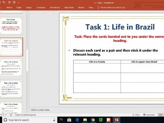
A series of 8 lessons covering the topic of Brazil. Activities are differentiated for higher and lower ability pupils. The lessons cover the location of Brazil, the rainforest, comparing life in England to Brazil and favelas. All PowerPoints and worksheets are editable.
A lesson introduction and activities used with a year 2 class to explore the temperature of different parts of the globe.
Introduces the idea of poles, as well as the Equator. The two different activities both relate to temperature - one asks children to make the varying temperatures on a world map; the other looks at animals in hot and cold environments.
This could link to science and habitats.
A colourful 23 page workbook which is currently used for a Year 7 Geography intervention class. Could be used in class or as a homework booklet. I would suggest use with KS2/KS3
What do you know about India?
India key words
Where is India map
Label feature of India on Map
Flag of India
Indian culture
India facts
Rangoli patterns
Population change in India
Changing India
Indian cities word search
The Thar Desert, an excellent eco system
Look, say, cover, write practice
Thirsty India, water management
Weather in India
Travelling to and from India
Geography skills
My own Indian flag
Updated and animated version of cjhinchliffe's powerpoint. I have made into a 2 session lesson plan focusing on: 1. where are bananas grown and why? 2. Climates and why bananas are not grown in the UK. 3. The journey of a banana. 4. Fair-trade / local produce questions.
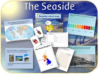
A set of powerpoint lessons looking at the history and geography of seaside holidays, plus activities, worksheets and display resources.
POWERPOINTS
Seaside mind map: For AfL
Seaside introduction: Looks at why we go to the seaside, and how it differs from other places. It shows pictures of the countryside, town, and seaside, asking children to point out the differences.
What is the seaside like?: Looks at photographs to explore the human and physical features of coastal locations
When do we go on holiday and what do we see?: Looks at the different times of year we have school holidays, and how they coincide with religious festivals. It shows photographs of different objects and activities at modern seaside resorts.
Seaside in the past: 18 seaside photographs from 1880 until the 2000s. The children are asked to talk about what they see in each picture.
Human and physical features: A study of Blackpool, with photographs and maps, to explore the key human and physical features of the resort. The children can match features they see in photographs to a map. There are also links to British seaside tourist websites.
Looking at aerial photographs: Eight seaside locations to look for human and physical features.
How has the seaside changed?: Six pictures of seasides in the past to look at and discuss.
Pictures of seasides in the past: Six pictures of seasides in the past to look at and discuss.
The Victorian seaside: A look at how seaside resorts developed, and why people in Victorian times enjoyed going to the seaside. It looks at the different things that children did at the seaside, and compares them to what children do today.
ACTIVITIES:
Acrostic poem
Aerial photographs of different seaside locations showing pictures of coastal locations around the UK
Playing cards
Colouring pictures
My favourite environment worksheet
Packing list: Ready to go on holiday
My seaside holiday with seaside border, to write a description
Passport of places visited to itemise and describe where they have been
Passport: A blank passport to fill in
Postcard; blank to fill in
Stamps to use on the postcards
Seaside border paper for writing
Seaside holidays in the past: Compare 2 pictures to see how things were different in the past.
Seaside pictures past and present: For activities such as ordering events, describing, comparing etc
Survey – places visited: For a class survey
Topic covers x 4: With ‘The Seaside’ / ‘Seaside Holidays’ headings
Town country seaside description: To describe the different areas
UK jigsaw: England, Northern Ireland, Scotland and Wales
UK map: To mark out places visited
What can you find at the seaside: For making a list
What can you see?
Pictures of the town, seaside and countryside to describe
Plus lots more!
Water Quiz for Early years Power Point
Simple interactive quiz for Early years.
It is good for provocation of science about water.
Use on slide show mode and click where you can find water.
sea
cloud
rain
snow
river
mist
groundwater
in the tree
lake
Works great on Interactive white board.
 Quick View