Line maps of the UK and Europe together with the country names and flags to connect.
Students can either label with lines or cut and stick labels into the correct nations.
Print/ photocopy onto A3 for a larger map.
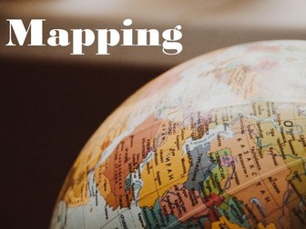
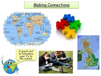
This is a KS3 geography lesson designed to introduce the basic concepts of geography to students.
This lesson is focused on making connections between the world on different scales.
A good lesson that enables the students to think about how the world intereacts on a local, national and international scale.
The students will learn how to see connects between the local, national and international.
A really good lesson.
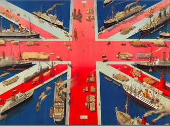
Complete and fully resourced lesson mapping the UK's connections with the rest of the world. Includes main trading partners for imports and exports. All tasks includes extension activities to stretch higher ability students, assessment task and marking feedback proforma. Could be used at KS3 or GCSE. Excellent introduction for new GCSE 9-1 spec.
This bundle contains a complete unit of work titled Making Connections. This is aimed for year 7's and is an ideal unit to begin the academic year. It looks at the different types of geography, the UK's physical and human features, locating continents and oceans, how to use an Atlas and some fieldwork based within your own school grounds.
A simple activity identifying by colour which countries are in the Northern Hemisphere and which are in the Southern Hemisphere.
All of my activities are created on an Acer Chromebook in a series of Posts on a Google Blog.
So, if you have a blog, or want to create one to try this concept out, simply copy and paste the text in the downloaded text file as a NEW POST and PUBLISH.
They are created as TEMPLATES for you to adapt and add your own content.
The screenshots can be downloaded simply as worksheets.
The original activity can be found at https://learnanytime-mycreations.blogspot.com/2024/02/hemispheres-connecting-by-colouring.html
The activities are meant to be fun, flexible and differentiated.
They are meant to develop transferable skills and be cross curricular.
As a result they hopefully reinforce small chunks of information and give a better understanding of a topic.
Most of the activities are aimed at UK National Curriculum KS1 and KS2.
learnanytime@gmail.com
Part of a fully resourced Year 7 SoW. Lesson 1 focuses on students making local, national and international connections. The maps will need adapting for your local area.
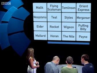
Use these 8 "Only Connect" boards as a starter/ bell work activity or as a stretch and challenge activity for KS3&4. Only Connect is a BBC2 TV show hosted by Victoria Coren where players are given a board of 16 words and their job is to find 4 sets of 4 connected words. The boards are easy to print and laminate and can add to your range of activities as starters, plenaries or used for stretch and challenge activities when students have finished the task set.
• By the end of the lesson, the students should be able to :
• Define connection
• Explain ways people are connected to places all over the world
• Explain map and scale
• Explain grid reference, measure distance and direction on the map
• Explain how to measure height on the map
• Use lines of latitudes and longitudes to locate places on map
There are two photocopiable worksheets here which accompany the Franklin Watts book 'Espresso Ideas Box: Where you live'. There is a sheet that allows the pupil to investigate a local building and one that encourages them to think of British connections – areas that have become famous for a craft, food or event in history. The activities stand alone, but using them in conjunction with the book will offer a more complete learning experience.
Making Connections - Autumn SOW Year 7
Covered:
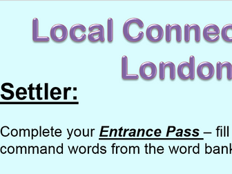
What is a local connections
Where is London, what are local connections in the area around us and in London
This is a Year 7 Unit of Work of 12 lessons including an assessment, assessment evaluation and an end of unit review. SOW also included. The activities are varied and engaging with all resources included. A glossary is included to get the students using the correct vocabulary.
I used this as a start point for teaching Year 7 in Term 1. It begins with the geographical concepts - this is lesson 1, the rest of the unit of work is on the TES website lesson by lesson - a 12 lesson unit in total.
![hemispheres [connecting by colouring]](https://l.imgt.es/resource-preview-imgs/3e355d16-6a3e-4227-8267-c603d07a6aec%2Fhemispheres.png?profile=res-img-med-legacy-v2)