Resources included are as follows:
46 pdf or ppt files.
Information pack about Ireland, key word cards, photo pack of Ireland, maps of Ireland, Ireland outline map, UK / GB definitions, A4 Flag for display, flag colouring pages, flag tasks.
Large lettering, display borders, backing paper to print if needed, long banner for title, buntings., I love Ireland poster.
Face masks in colour and black and white, hand puppets in colour and black and white.
Drawing activities, design a rugby t-shirt, writing and drawing frames, reward chart, badges, word search, writing booklet cover, booklet to make, true or false quiz, sentences writing sheets, mind map, diary writing, presentation cue cards, alphabetical order worksheet, flight / coach / train tickets to complete, size order activity, passport to complete, postcard template, luggage tag to complete, Euro coin collage to make, resources sack tag and folder cover.
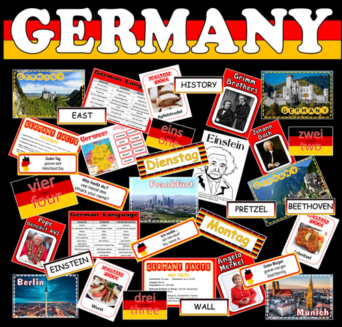
Resources include:
Germany information pack, giving details of key facts, geography, climate, famous people, etc
Photo pack of scenery around Germany, photo pack of all the major cities of Germany famous German people flashcards, number flashcards, food flashcards, etc
Key word cards for discussion or display, large lettering, long banner, buntings, plain and patterned borders, flags of Europe, maps of country / continent / world / blank, map and flag tasks, treasure hunt game, quiz, etc, bingo game, writing activities, colouring pages, drawing activities, role play activities, research task, mind map
Days / months/ common phrases of the week flashcards in English and German
German history timeline information from 500BCE to current day
Resources included are as follows:
PDF files for you to print.
A great signpost to display around your classroom or school.
Includes 30 different worldwide destinations.
Each flashcard has the name of a capital city, the direction it is FROM LONDON and the distance.
Two sets of flashcards are included – one set in miles and the other set in kilometres.
Chose to display just a few signs or all of them. You could make one signpost or several depending on the display area.
Each sign is half an A4 in size landscape. You can print smaller by selecting options on the printer screen or photocopy them larger.
Also includes display lettering for title.