Resources include:
A set of 28 colourful A4 posters showing all the key words associated with rivers and an explanation for each.
A information pack giving key facts about 10 major rivers - facts include things such as length, location, tributaries, dams etc.
A photo pack of 10 major rivers, showing how unique each river is.
56 PDF FILES for you to print.
Country information pack including details about geography, general key facts, history, religion, sports, etc
Photo pack, flags of the continent pack, key word cards, large lettering to head wall display, long banner, folder covers, flag buntings, airport departure board with word and letters, passport template, luggage tag and flight tickets to complete, food flashcards, animal flashcards, famous people from India flashcards, language resources including numbers, days and months, diary writing task, card matching game, maps of the world, maps of Asia, maps of India, map of languages spoken across India, blank map to complete, lunchbox task, A4 flag, flag to colour, reward chart, mind map, make a presentation task, make an information booklet, colouring page of traditional dress, continent fact sheet, country fact worksheet, famous landmark research task, draw favourite things, name cities task, notes pad, collage to create, bingo game, quiz to complete, story board, word search, sentence summary worksheet, work booklet cover, writing borders, postcard to complete, patterned and plain display borders, backing paper, resources sack tag.
Resources included are as follows:
P D F FILES
Alphabet letters
Numbers 0-9
Question mark, exclamation mark, comma and full stop
Each globe is 16 cm in diameter
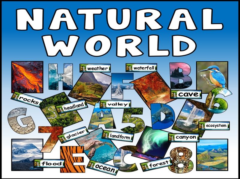
Resources included are as follows:
PDF FILES
Alphabet letters with photo pattern inside (A 5)
Numbers 0-9 with photo pattern inside (A 5)
Question mark, exclamation mark, comma and full stop with photo pattern inside (A5)
40 half page photos of the natural world to use for display
50 (half page landscape) key word flashcards
Resources included are as follows:
Animal flashcards showing a picture of the animal with name in Czech
Food flashcards showing a picture of the food with the word in Czech
Colour flashcards
Transport flashcards showing different transport such as car, taxi,
Days of the week flashcards
Months of the year flashcards 1 set of months in Czech and another set of English
Numbers in English and Czech on large flags
Common phrases flashcards
Body parts flashcards with photos
Large flag for display
Large lettering to head wall display
Blue and red display borders to edge wall display
Resources sack tag to keep everything together once printed
Long banner
Bunting
Booklet cover and writing borders
Maps of Czech Republic
Photo pack of scenery in Czech Republic
Resources included are as follows:
45 Pdf files for you to print.
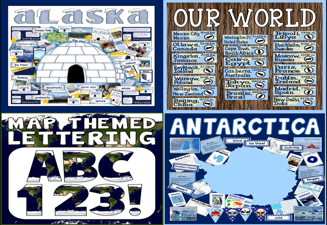
information pack, Photo pack, maps of state/country/continent/Arctic/world, map to colour, A4 flag, key word cards, writing booklet cover, resources sack tag, writing page border, topic summary sheet, acrostic poem, mind map, animal flashcards, adjectives cards, booklet to make, cue cards for presentation, diary to write, long banner to head display, lettering, display borders, topic flashcards such as glacier, igloo etc, research task, research note pad, conversation to write, letter to write, several other writing tasks.
Resources included are as follows:
38 PDF files for you to print.
Information pack about Antarctica, photo pack, a range of posters and information sheets, key word flashcards, cut and stick activities for continents, label the continents, writing sheets, flag and activity, compass to use for display, acrostic poem to complete, animal flashcards, booklet to make, animal lists task, maps, collage to make, fact sheet to complete, presentation cue cards, mind map, sentence writing sheet, word search, large lettering patterned and plain, long banner to head display, buntings etc.
Resources included are as follows:
PDF files for you to print.
A great signpost to display around your classroom or school.
Includes 30 different worldwide destinations.
Each flashcard has the name of a capital city, the direction it is FROM LONDON and the distance.
Two sets of flashcards are included – one set in miles and the other set in kilometres.
Chose to display just a few signs or all of them. You could make one signpost or several depending on the display area.
Each sign is half an A4 in size landscape. You can print smaller by selecting options on the printer screen or photocopy them larger.
Also includes display lettering for title.
Resources included are as follows:
45 PDF files for you to print.
Information pack about St Andrew’s Day, UK information pack, Photo pack of locations in Scotland, photo pack of general Scottish things, key word cards, Scotland fact cards, flag descriptions for the UK, definition posters of UK / GB and BI, A4 flag, flag to colour, title page to introduce topic, maps of GB and UK, maps of Scotland, outline maps to colour/ label,
Colouring pages, diary to write for the Loch Ness Monster, themed writing pages, mind map, writing booklet cover for project work, sentence summary worksheet, word search.
2 Long banners to head display ‘Scotland’ and ‘St Andrew’s Day’, large lettering, buntings for decoration, display border, backing paper to print if needed, binder cover and drawer labels, resources sack tag. Reward chart, Loch Ness Monster face mask in colour and black and white, Loch Ness Monster hand puppet in colour and black and white, hand puppet template, ‘All About…’ booklet to write, alphabetical order worksheet, drawing task, tallest mountains posters, badges etc
Resources included are as follows:
PDF FILES
Decorated alphabet letters A-Z (A5)
Decorated numbers 0-9 (A5)
Decorated question mark, exclamation mark, comma and full stop (A5)
Resources included are as follows:
40 pdf files.
Information pack about St George’s day origins and traditions, key word cards, photo pack of England’s major cities, photo pack of English food, photo pack of English landmarks., maps of England, England maps and outline map, definition posters of UK/GB/BI
Large lettering, display borders, long banner for title, backing paper, buntings, happy st George’s Day poster, resources sack tag, binder cover.
Dragon face masks in colour and black and white, hand puppets in colour and black and white. drawing activities, writing and drawing frames, reward charts, badges, word search, writing booklet cover, booklet to make, St George’s flags in colour for display and to colour in, alphabetical order worksheet, diary writing sheet, mind map, sentence writing sheets, size order roses cards, true or false quiz.
Resources included are as follows:
46 pdf or ppt files.
Information pack about Ireland, key word cards, photo pack of Ireland, maps of Ireland, Ireland outline map, UK / GB definitions, A4 Flag for display, flag colouring pages, flag tasks.
Large lettering, display borders, backing paper to print if needed, long banner for title, buntings., I love Ireland poster.
Face masks in colour and black and white, hand puppets in colour and black and white.
Drawing activities, design a rugby t-shirt, writing and drawing frames, reward chart, badges, word search, writing booklet cover, booklet to make, true or false quiz, sentences writing sheets, mind map, diary writing, presentation cue cards, alphabetical order worksheet, flight / coach / train tickets to complete, size order activity, passport to complete, postcard template, luggage tag to complete, Euro coin collage to make, resources sack tag and folder cover.
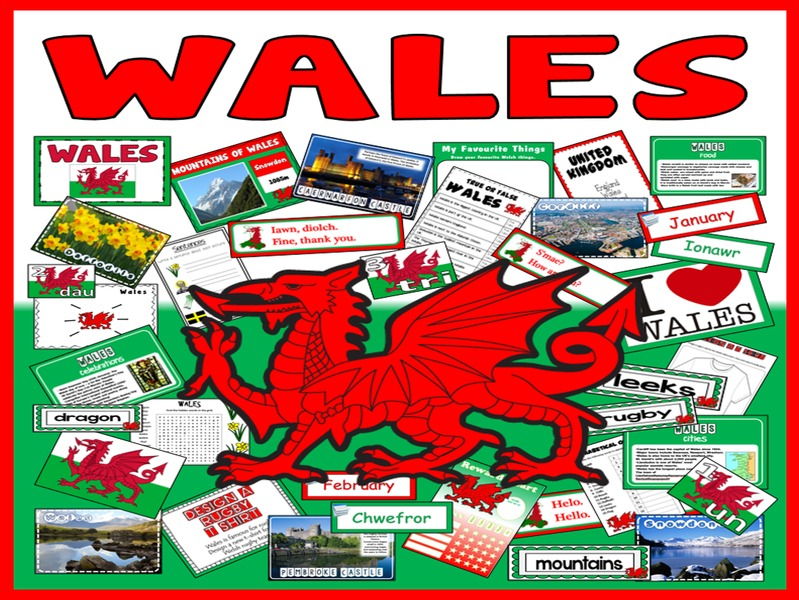
Resources included are as follows:
50 pdf files.
Information pack about Wales, key word cards, photo pack of Wales, maps of Wales, Wales outline map, UK / GB definitions, castle photo pack with facts, mountains posters with heights, A4 Flag for display, A4 flag to colour, number flashcards 1-20 in Welsh, common phrases flashcards in English and Welsh, days of the week and months of the year flashcards in English and Welsh
Large lettering, display borders, long banner for title, buntings, other large images to make a display board., I love Wales poster.
Face masks in colour and black and white, hand puppets in colour and black and white.
Drawing activities, design a rugby t-shirt, writing and drawing frames, reward chart, colouring pages, badges, word search, writing booklet cover, booklet to make draw daffodils task, true or false quiz, sentences writing sheets, mind map, diary writing, presentation cue cards, alphabetical order worksheet, coach and train tickets to complete, size order activity, resources sack tag and folder cover.
Resources included are as follows:
30 A4 population posters for different countries. Each poster has a map and some population information about the country.
30 A4 posters of photos from each country.
A4 posters of key words with explanations.
Long banner to head wall display.
Large lettering for title.