
103Uploads
140k+Views
52k+Downloads
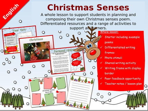
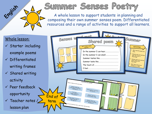
English - Poetry - Summer Senses Poem
A whole lesson to support students in planning and composing their own summer senses poem. Differentiated resources and a range of activities to support all learners.
Ideal for supporting SEN pupils in the writing of a summer senses poem.
This resource would be a great activity for the end of term.
A great way to introduce poetry to KS1 or SEN learners.
Whole lesson:
Starter including example poems
Differentiated writing frames
Shared writing activity
Differentiated resources
Peer feedback opportunity
Teacher notes / lesson plan
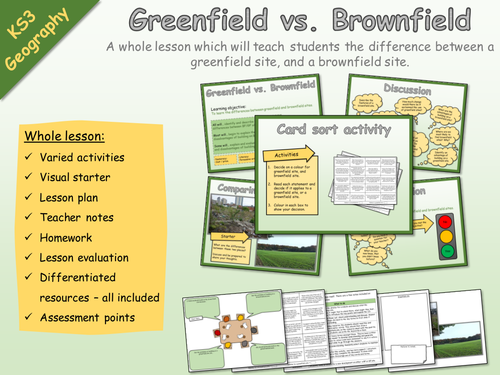
KS3 Geography - Settlement - Brownfield and greenfield sites
KS3 Geography - Settlement - Brownfield and greenfield sites
A whole lesson which will teach students the difference between a greenfield site, and a brownfield site.
Whole lesson:
Varied activities
Visual starter
Lesson plan
Teacher notes
Homework
Lesson evaluation
Differentiated resources – all included
Assessment points
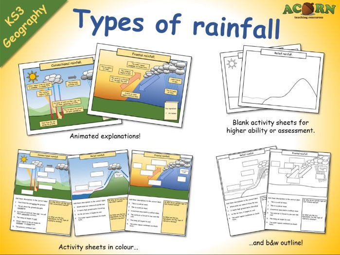
Types of rainfall (animations and activity sheets)
Types of rainfall (animations and activity sheets)
These are lesson elements intended to be used in the teaching of weather/climate and types of rainfall.
- Three colourful animations to introduce / teach convectional, frontal and relief rainfall.
- Three activity sheets with diagrams / written work.
- Three outline activity sheets which can be used with higher ability students, or to assess.
All reviews for our premium resources have been 5/5 (As of February 20th 2017)

Easter Acrostic Poems - examples and templates
- 3 Easter themed acrostic poems to use as examples / teaching elements.
- 5 Easter themed poem templates (also in black & white) for students to write their work up on (great for display).
Intended to be used as elements within, or as a full lesson.

Geography - Coasts - Erosion - Coastal Landforms
Three labelled PPT diagrams to include in a lesson, to help when teaching...
- Cliffs and wave cut platforms
- Caves, arches, stacks and stumps
- Headlands and bays
Three worksheets to help students learn or demonstrate understanding. The worksheets have several tasks to help the students complete the diagram and link it to the processes of erosion.
As of the 20th January, every single review we've had for a premium resource has been 5/5*

Geography - Living in squatter settlement - Activity sheets
Two activity sheets intended to be used as part of a lesson. The theme of the lesson should be along the lines of ‘Life in a squatter settlement’, and could be taught with KS3 or KS4 students.
Resource 1: the effects on peoples lives
The main aim is for students to appreciate how the conditions / characteristics of a squatter settlement affect people’s lives.
The task is for students to complete the sheet in a few different ways.
There are nine problems / effects associated with living in a squatter settlement. For each effect, they must list the associated problems, and for several, also draw the problem. Ask the students the question – how would this affect your life if you lived there? There will be some repetition.
There are three blank cards as well, these are intended for higher ability students, or for the teacher to edit so as to include a problem which may be appropriate to the theme of their teaching.
Higher ability students can cut the cards out afterwards and glue them in their exercise books – this is an opportunity to identify links between the problems. There are several, and the whole activity is very open ended. Students could also sort their ideas into social, political and economic – they could use three different colours and a key to show this.
There are some answers on the next sheet, although there are many more.
Resource 2: the informal economy of a squatter settlement
The main aim is for students to appreciate how people can earn money within a squatter settlement. The focus should be on how the work is informal and doesn’t contribute to the tax base / official figures. This kind of work can be contained within a squatter settlement, but not necessarily so. This is an opportunity to draw a strong link to rural-urban migration; how the residents are often uneducated and unskilled, but wanting and needing to work.
The task is simple, for each form of employment, the student must draw an appropriate illustration. Model for lower ability, ask higher ability to include speech bubbles, or some form of written communication. Use as an opportunity to clear up any misunderstanding about what each term means.
All reviews for our paid resources have been 5/5* (as of March 19th 2017)
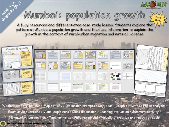
Urban issues and challenges - Mumbai (population growth)
GCSE Geography - Urban issues and challenges -Mumbai (population growth)
A fully resourced and differentiated case study lesson. Students explore the pattern of Mumbai’s population growth and then use information to explain the growth in the context of rural-urban migration and natural increase.
Whole lesson > Visual mind-map activity > Discussion prompts > Key ideas > Graph activities > Photo analysis > Exam style questions > Visual explainers > Class discussion > Learning evaluation > Summary activity > Homework > Lesson plan > Teacher notes > Fully resourced > Visually attractive and ready to teach!
The main aim is…
For students to describe the scale of population growth in their NEE case study of Mumbai.
To explain the growth (link to rural-urban migration and natural increase) specific to Mumbai.
To understand how rural-urban migration and natural increase are driving urbanisation in their city
Key ideas and content…
Rural – urban migration drives population growth
Population growth drives natural increase
Most migrants are young (natural increase)
Mumbai is a dominant and important city which attracts migrants (rural-urban migration)
The growth of Mumbai can be explained by a series of events in the history of the city
Rural-urban migration and natural increase are linked
NEE’s are likely to experience rapid urbanisation / population grown in cities because of their socio-economic contrasts
To differentiate…
Use the differentiated resources as appropriate.
Include discussion prompts and time the lesson accordingly
To extend…
Students can peer assess / improve their exam questions or photo analysis answers.
Change/adapt the exam style questions
Students can develop their own questions with mark schemes.
Higher ability should be given the opportunity to link the statements about Mumbai to one another
To assess…
The photo analysis offers some assessment opportunity if a focus is given to linking concept/theory to what’s happening in Mumbai
The line/bar graphs aren’t suitable in terms of content, however as a skill they could be assessed for accuracy
The exam style questions offer a summative assessment opportunity for the lesson.

Urban issues and challenges - Mumbai (managing urban growth - squatter settlements)
A fully resourced and differentiated lesson teaching students about the development of squatter settlements in the context of Mumbai. Students will link characteristics and conditions (including the informal economy) to wider geographical processes.
Whole lesson > Photo analysis > Discussion prompts > Key ideas > Storyboard activities > Photo analysis – progress check > Exam style questions > Class discussion > Learning evaluation > Visual explainers > Homework > Lesson plan > Teacher notes > Fully resourced > Visually attractive and ready to teach!
The main aim is…
To establish the key characteristics of a squatter settlement.
To explain how they develop and then evolve over time.
To explain the difference between the formal economy and the informal economy.
To link squatter settlements to geographical concepts; urbanisation, rural-urban migration natural increase
Key ideas and content…
Squatter settlements are areas of informal housing where an informal economy often develops.
They evolve and change over time.
There are unique social / environmental conditions with impact quality of life.
They form because of a rapidly growing population.
To differentiate…
Several activities are differentiated – use the resources accordingly.
Photo analysis tasks can be completed as a class / groups / pairs
For the exam questions give lower ability students – display the connectives and key terms.
The discussion can be completed as a class / group.
To extend…
For the exam questions give time for middle and higher ability students to decide on their own connectives and key terms.
Provide a photo of a squatter settlement prior to the lesson – ask students to mind map what they know about squatter settlements. Add to / improve at the end.
Higher ability could read the definition of a squatter settlement and then write their own.
To assess…
The exam questions should be peer assessed.
There are several exam questions throughout the lesson, any of these could be given a mark and assessed.
The discussion prompts allow for summative assessment.
www.acornteachingresources.com

Urban issues and challenges - Mumbai (urban challenges - water, sanitiation and energy)
Urban issues and challenges - Mumbai (urban challenges - water, sanitiation and energy)
A fully resourced and differentiated lesson teaching students about the challenges in providing adequate access to water, sanitation and energy in Mumbai.
Whole lesson > Photo analysis > Discussion prompts > Key ideas > Differentiated activities > Summary activity > Class discussion > Learning evaluation > Card sort activity > Key term starter > Homework > Lesson plan > Teacher notes > Fully resourced > Visually attractive and ready to teach!
The main aim is…
To explore the challenges in providing water, sanitation and energy in Mumbai (case study)
Key ideas and content…
There are serious social challenges in providing water, sanitation and energy.
Water and sanitation are linked to health and social well being.
People living in squatter settlements (because of rapid urbanisation and poverty) are less likely to have adequate access to amenities such as water, sanitation and energy.
Mumbai is a good example of a city where people don’t have adequate access to amenities such as water, sanitation and energy.
To differentiate…
Work through the card sort activity as a class.
Students could complete the discussion, linking activity and photo analysis in groups / pairs.
Pass the photo analysis around, students improve each other’s work.
To extend…
Students could form their own sentence starters (and share them).
To assess…
The photo analysis and the summary activity offer assessment opportunities.
Class discussion and evaluation prompts.
www.acornteachingresources.com

Urban issues and challenges - The emergence of megacities
AQA GCSE Geography - Unit 2 Section A - Urban issues and challenges - The emergence of megacities
An activity packed and differentiated lesson teaching students about the characteristics of a megacity, their growth and their location. Included is a wide range of resources which can be applied in many ways.
Whole lesson > Key concept starter > Discussion prompts > Key ideas > Map/distribution activity > Graph skills > Photo analysis > Exam style questions > Class discussion > Learning evaluation > Summary activity > Homework > Lesson plan > Teacher notes > Fully resourced > Visually attractive and ready to teach!
The main aim is…
To teach students about the characteristics of a mega city, their location, their growth (and reasons for it)
To link to key concepts such as urbanisation and migration.
Make it clear ‘world cities’ share many of the same characteristics – it’s the population, the magic number, which makes it a mega city.
Statistics and population data vary. For example, Paris has a population a little over 2 million, however, in some figures a wider area is taken into account. Make this clear to the students. The emphasis should really be on the growth (the emergence) of megacities in NEE’s.
Key ideas and content…
Mega cities have a population of over 10 million people.
They have similar characteristics – similar to those of world cities.
Their emergence is mostly in Asia and more recently, Africa. There is a pattern!
The number of mega cities has grown significantly over the last 50 years.
Rural-urban migration and natural increase are driving rapid urbanisation in LIC/NEE’s.
To differentiate…
Several activities have been differentiated already – use sheets as appropriate.
Discuss and model the exam style questions.
Allow independent / group thinking time for the discussion.
Provide the key terms as a checklist when answering questions.
To extend…
Students can add information / data to the maps.
The data could be presented in different ways.
Actual examples can be added to the photo analysis activity.
Students could develop their own mark scheme for the exam style questions.
To assess…
Use the exam style questions as an assessment opportunity.
Assess the distribution description to assess distribution questions.
English - Contractions - Activities & Games
Activities, games and homework to teach contraction.
Includes a word wall which can be used for display.
www.acornteachingresources.com
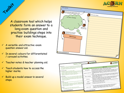
Exam question technique sheet
The main aim is…
This is an exam question answer planning tool. It was developed for lower ability students; to help them form an answer to a long exam question and to practise their exam technique.
It is intended to help students see they do have the necessary understanding, but also answer the question correctly to achieve the higher marks.
Key ideas and content…
The students tackle an exam question in steps.
The idea is the students have everything they need on the sheet in front of them, to help focus lower ability students and coach them in answering longer exam questions.
Students can apply the same process to an actual exam.
Students can develop their exam question technique (application of key terms, use of connectives, structure etc.) to access the higher marks.
To differentiate…
Work through the steps as a class, then allow the students to answer the actual question.
If using a structure – give time for teach section (a minute per mark?).
Before photocopying, provide subheadings to help students structure their answer.
Several colour coded versions have been included to enable carousel activities / differentiated activities / group work etc.
To extend…
Higher ability students could write their own mark scheme for the question on the back.
Attach SPaG marks.
Use the sheet with the ‘structure’ box instead of the thought bubble. The students will have to draw the horizontal lines depending on the structure / number of paragraphs.
Higher ability students could plan their answer on the lined graphic, and then write their actual answer on lined paper / on the back.
To assess…
Can be assessed by the teacher against the mark scheme.
Provide students with a mark scheme and allow them to assess/see where the marks come from.
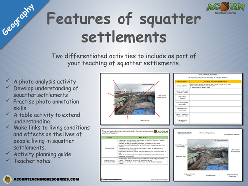
Features of squatter settlements - differentiated activities
Two differentiated activities to include as part of your teaching of squatter settlements.
A photo analysis activity
Develop understanding of squatter settlements
Practise photo annotation skills
A table activity to extend understanding
Make links to living conditions and effects on the lives of people living in squatter settlements.
Activity planning guide
Teacher notes
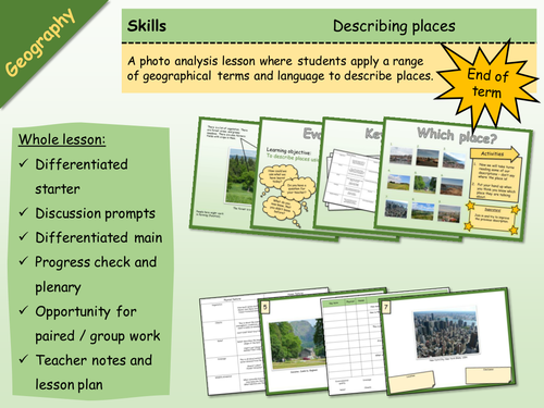
Geography - Skills - Describing Places
A big lesson with lots of opportunity for differentiation and engagement, as well as paired or group work.
Basically, students learn how to describe places, and then apply this skill. It would work well as a skills building lesson in KS3, or as an end of term type lesson with either KS3 or KS4.
There are differentiated resources for lower and higher, and a number of ways in which the activities could be undertaken (which are in the lesson plan). There are teacher notes and a lesson plan. The activities are clear, and there are Superstar extension activities.
---
The main aim is…
This is a big lesson which could be used as an end of term activity, or as a skills building lesson.
Students either learn or develop their geographical terminology and then apply / demonstrate using photos of actual places.
Key ideas and content…
We can describe places using geographical language.
It is more effective to use the correct key terms and descriptive language.
To differentiate…
Pass the sheets round on a timer, with the challenge of either adding more key terms or improving existing ones.
Stick the sheets on the wall around the room, give each student a different key term to look for. Students go round the room.
Insist on certain terms being applied.
To extend…
Insist on a description of features which aren’t necessarily visible.
Students find their own photos and analyse them.
Peer assessment.
There are some tricky terms in the key terms activity, use to stretch students.
To assess…
Discussion points.
The work produced.
Peer assessment opportunity.
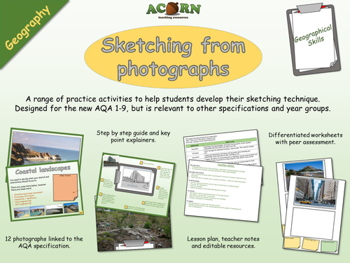
Geography - Geographical skills - Sketching (field and from photos)
A range of practice activities to help students develop their sketching technique. Designed for the new AQA 1-9, but is relevant to other specifications and year groups.
The lesson would be particularly useful to a GCSE group before they do their fieldwork, and will also be suitable for a KS3 class.
There are also detailed 'key points' so students understand why they need to know how to sketch, and what technique makes it effective. On top of the field sketching there is a focus on application of key terms.
The lesson has a range of visual resources, all relevant to the new 1-9 GCSE.
A free wallchart is available to download at https://www.tes.com/teaching-resource/geography-geographical-skills-sketching-wall-display-11486949
The main aim is…
To develop and practice field sketching / sketching from photographs technique.
To effectively annotate and label sketches to show understanding.
Key ideas and content…
This is a practical lesson which would benefit from lots of student interaction and discussion.
There are links to content, but it would work without – solely as a sketching lesson.
To differentiate…
Use the resources with the picture above a blank box for weaker groups.
Focus on the same photos.
Print the checklist.
Display the photos on the board and discuss as a class.
To extend…
This lesson could be used several times in the same format.
The teacher can add their own photos.
Take the class on a local visit to practice the technique.
Provide word banks for annotations.
To assess…
Peer assessment is woven into the main activity.
Teacher should be able to see visual progress with the quality of sketching and level of annotations.
All reviews for our premium resources have been 5/5 (as of 17th January 2017)
www.acornteachingresources.com
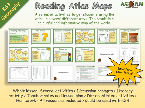
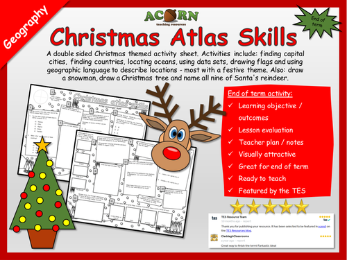
Geography - Reading Atlas Maps
*Requires an Atlas*
Originally aimed at KS3 but can be used with KS4. Ideal for cover, and getting to know groups. Gives lots of opportunity to talk about physical and human features around the world.
A series of activities to get students using the atlas in several different ways. The result is a colourful and informative map of the world.
Whole lesson: Several activities > Discussion prompts > Literacy activity > Teacher notes and lesson plan > Differentiated activities > Homework > All resources included > Could be used with KS4
The main aim is…
For students to use the atlas in several different ways to efficiently find information.
To complete a colourful and informative map of the world.
Every review we've had for a premium resource has been 5/5 (as of 2nd February 2017)

Geography - Settlement Shapes (Whole lesson)
Geography - Settlement Shapes (Whole lesson)
A whole lesson with a range of differentiated activities aimed at teaching students the features of, and differences between; linear, nucleated and dispersed settlement shapes.
Includes: snappy starter, animated explainers, key points, class discussion, differentiated activities, assessment opportunities, a homework task and lesson evaluation. All resources are included, along with a lesson plan and teacher notes.
The main aim is…
For students to learn the features of, and differences between linear, nucleated and dispersed settlement shapes.
Key ideas and content…
Nucleated, linear and dispersed are all settlement shapes.
Settlements grow in different shapes for different reasons.
Nucleated settlements will grow around a feature.
Linear settlements will grow along a feature.
To differentiate…
There is differentiation in the lesson.
Provide the essential words for the summary activity.
Students could work on the photo analysis together.
To extend…
Use the superstar activities.
Get the maps out / photocopy and cut out to pick out actual settlement shapes.
To assess…
The photo analysis and the summary activity allow progress to be demonstrated and assessed.
The homework could also be assessed.
All reviews for our premium products have been 5/5* (As of 21st February 2017)
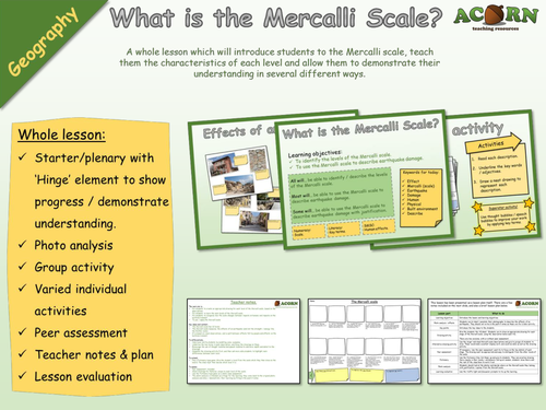
Geography - Natural Hazards - Earthquakes - Mercalli Scale drawing activity
A whole lesson which will introduce students to the Mercalli scale, teach them the characteristics of each level and allow them to demonstrate their understanding in several different ways.
Whole lesson:
Starter/plenary with ‘Hinge’ element to show progress / demonstrate understanding.
Photo analysis
Group activity
Varied individual activities
Peer assessment
Teacher notes & plan
Lesson evaluation
The main aim is…
For students to create an appropriate drawing for each level of the Mercalli scale, based on the descriptions.
For students to learn the main levels of the Mercalli scale.
For students to recognise how the scale changes between impacts on humans and impacts on the build environment.
To use / apply the Mercalli scale.
Key ideas and content…
The Mercalli scale has 12 levels.
The Mercalli scale measures the effects of an earthquake (and not the strength / energy like the Richter scale).
It is based on visual observations, and is split between effects felt by people and effects on the build environment.
To differentiate…
Help lower ability students by modelling some examples.
Underline the key terms in each description, and focus the drawings on these.
Encourage the use of thought bubbles and speech bubbles to add more depth and detail to the drawings.
Complete the drawing activity first, and then ask more able students to highlight main differences between each level.
To extend…
Play a Pictionary type game. Give the student a level from the scale which they then draw on the board. The class must then decide which level it is.
To assess…
Peer assessment included.
Check drawings for features unique to each level of the scale.
Use the Pictionary type game as a whole class assessment.
The photo analysis is intended as a Hinge for the learning, they come back to the original photo analysis and show / demonstrate their learning by filling in the post-it notes.
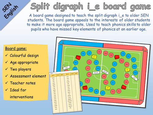
SEN English - Phonics - Split digraph i_e football board game
A board game designed to teach the split digraph e_e to older SEN students. The board game appeals to the interests of older students to make it more age appropriate. Used to teach phonics skills to older pupils who have missed key elements of phonics at an earlier age.
Board game:
Colourful design
Age appropriate
Two players
Assessment element
Teacher notes
Ideal for interventions
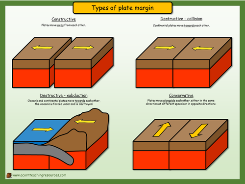
Geography - Display - Types of plate margin
Print in A3
A simple wall display to show the direction of plate movement.
www.acornteachingresources.com