The perfect place for all your EYFS, KS1 and KS2 resources, Explore Education aims to provide you with amazing, outstanding lessons that help you to shine. Each lesson often has detailed planning, PowerPoints and differentiated resources. So whether you are looking for a maths lesson to get you through your next interview, an English lesson that will help you impress OFSTED or a history, science, RE, PSHE or PE unit to wow your class, this is the shop for you!
The perfect place for all your EYFS, KS1 and KS2 resources, Explore Education aims to provide you with amazing, outstanding lessons that help you to shine. Each lesson often has detailed planning, PowerPoints and differentiated resources. So whether you are looking for a maths lesson to get you through your next interview, an English lesson that will help you impress OFSTED or a history, science, RE, PSHE or PE unit to wow your class, this is the shop for you!
Take your students on an exciting journey through Europe with this outstanding geography lesson! In this comprehensive lesson, students will learn to use compass directions, 4-figure grid references, symbols, and map keys to explore the geography of Europe. Through engaging activities and interactive discussions, students will develop the skills to accurately navigate maps and interpret important geographical information.
The lesson begins with a stimulating starter discussion on the significance of directions and grid references in map exploration. Then, students will be introduced to the 8 points of a compass, understanding their corresponding directions within Europe. A captivating map of Europe will showcase key symbols and a map key, enabling students to grasp the meaning behind these symbols and their representation of various geographical feature.
The lesson continues with three hands-on activities that reinforce learning. In Activity 1, students use small maps of Europe to label the 8 compass points and practice giving directions to specific countries or cities. Activity 2 focuses on 4-figure grid references, where students locate points on their maps and identify corresponding countries or cities. Working individually or in pairs, students enhance their map-reading skills and strengthen their accuracy. In Activity 3, students collaborate in small groups to place symbol cards representing different geographical features on a large map of Europe. Through discussions and referencing the map key, students deepen their understanding of Europe’s geography.
To conclude the lesson, a plenary discussion reviews the concepts covered, allowing students to share their newfound knowledge and showcase their skills by identifying specific countries, cities, or geographical features on a map of Europe. Ongoing assessment throughout the lesson helps monitor students’ participation and understanding.
This outstanding geography lesson comes with a comprehensive set of resources, including a 23-slide PowerPoint presentation, maps of Europe, activity sheets, symbols key, compasses (optional), and answers for convenience. Engage your students’ curiosity and foster their map-reading abilities with this immersive and educational lesson on Europe’s geography.
Have any issues with this resource or a request? Contact us directly for the quickest response at: explore_education@outlook.com
A lesson about longitude and latitude for geography. All resources provided. This lesson has been successfully used for a lesson observation and includes an interactive PowerPoint, worksheets, resources, planning and video song.
L.O. To learn to identify the position and significance of the lines of Latitude, Longitude, Tropic of Cancer, Capricorn and Equator.
Success Criteria:
I can differentiate between weather and climate.
I can label lines of Latitude, Longitude and the Tropics.
I can explain what the lines are used for and their direction.
I can create sentences about countries using the lines to describe their whereabouts.
Resources Included:
PowerPoint
Lesson Plan
Starter Task Worksheet
World Map Activity
Coordinates for main activity
Writing task
Success Criteria Strip
Longitude and latitiude song video
Extension task
WAGOLL Example Map
Sentence starters for LA
Word bank
Tags: ks2 ks3 y3 y4 y5 y6 humanities atlas map mapping weather climate nqt ect interview Climate change Travel and tourism What is Geography Structure of the earth year 3 year 4 year 5 year 6 longitude and latitude ks2 worksheet ppt finder google maps calculator meaning london games tes activity song display teaching latitude and longitude topic
This Europe Geography Unit is a comprehensive and engaging teaching resource designed for Key Stage 2 children to explore various aspects of Europe, including famous landmarks, cultural similarities and differences, and the impact of human activity on the environment. The unit consists of eight lessons, each targeting specific learning objectives and accompanied by a range of interactive activities and discussions.
Lesson 1: Introduction to Europe
In this lesson, students are introduced to the continent of Europe and its diverse countries. They learn about the significance of Europe, its geographical features, and the countries that make up the continent.
Lesson 2: Exploring European Landmarks
Students delve into the fascinating world of famous landmarks in Europe, such as the Eiffel Tower, Colosseum, Big Ben, and more. They learn about the historical and cultural importance of these landmarks, their locations on a map of Europe, and engage in activities like landmark descriptions and map marking.
Lesson 3: Cultural Similarities and Differences
This lesson focuses on the cultural aspects of different European countries and compares them to the students’ local area. Students learn about traditions, customs, and languages, and engage in activities like creating travel brochure collages and group discussions about dream European holidays.
Lesson 4: Trade and Travel Connections
Students explore the trade and travel connections between Europe and their local area. They analyze import and export of goods, tourism, and transportation networks, and evaluate the impact of geographical factors on these connections.
Lesson 5: Planning a European Travel Adventure
In this lesson, students plan an imaginary travel adventure to visit multiple European landmarks. They research the landmarks, their locations, and plan an itinerary, considering factors like transportation, accommodations, local cuisine, and cultural experiences.
Lesson 6: Expressing Personal Views about European Locations
Students learn to express their opinions and preferences about specific European locations, providing clear reasons for their views. They engage in discussions and debates, considering factors like climate, landmarks, culture, or personal interests.
Lesson 7: Geographical Similarities and Differences
This lesson focuses on understanding geographical similarities and differences between Spain and the students’ local area. Students explore traditions, customs, languages, and analyze trade and travel connections, considering the impact of geographical factors.
Lesson 8: Graphing and Comparing Geographical Data
Students gather and analyze data related to temperature and rainfall in specific European locations. They create graphs to represent the data accurately and compare and interpret the data to draw conclusions about environmental conditions.
This resource provides a comprehensive and well-structured unit for teaching outstanding geography lessons about Europe to Key Stage 2 children. It incorporates a variety of interactive activities, discussions, and opportunities for reflection, promoting critical thinking and global awareness among students. The lessons are designed to engage and inspire students while fostering their understanding of landmarks and cultures. Also suitable for Key Stage 3.
KS2 LKS2 UKS2 KS3
An outstanding Anglo-Saxons and Vikings unit that covers all you need to know. Suitable for Y4/Y5 but can be adapted to Y3 or Y6 easily. All worksheets needed provided and detailed PowerPoints for each lesson. Detailed planning also provided. Includes:
L.O. To understand who the Vikings were and how they lived.
Success Criteria
I know the countries the Vikings came from
I know when they lived
I know a little about why they came to England
I know about their everyday life
L.O. To understand what made the Viking longboat so successful
Success Criteria
I know what the keel is and why it helped the boat to move through the water
I know what the sail was made from
I know the materials the longships were made of
I know why there was a carved masthead
I can show what I know by labeling my drawing
L.O. To understand why the Vikings traveled to England and why some chose to settle here
Success Criteria
I can work with my team to produce and trade goods
By the end of the lesson I will know what difficulties the Vikings faced and why some chose to stay in England.
and 5. L.O. To understand why the Vikings raided Lindisfarne and describe the events through poetry.
Success Criteria
I understand the events of Lindisfarne including why the Vikings raided
I can understand the feelings of both sides of the raid
I can chose interesting vocabulary to show what I know through my poem
and 7. L.O. To understand who the Anglo-Saxons were and how they lived
Success Criteria
I know the countries the Anglos and Saxons came from
I know when they lived
I know a little about why they came to England
I know about their everyday life
L.O. To be able to use the internet to research an area of Viking life
Success Criteria
I can use google to search for information by typing in key words
I can make notes about what I have read- not just copy!
I can share my facts with detail
I can make notes based on other children’s facts
L.O. To know facts about Viking gods and show what I know through drawing
and labelling a picture.
Success Criteria
Make notes about some of the Viking gods
Use these notes to draw and label my favourite god
L.O. To be able to discuss open ended questions linked to the Vikings
Success Criteria
Listen to others - don’t interrupt
If you want to talk, hold out your hand
Respond to what others have said
Try to join in
Have any issues with this resource or a request? Contact us directly for the quickest response at: explore_education@outlook.com
KS2 History year 3 year 4 year 5 year 6 knowledge skills lks2 uks2 long ship longship
An outstanding WWI unit that covers all you need to know about the First World War. Suitable for KS2. Detailed lesson plans, PowerPoints and resources for each lesson.
Includes:
Locate countries involved
How the World War I started
Timeline
Propaganda artwork and posters
What trenches were and how they were used
What life was like in the trenches
Affect on people at home
Understanding WWI poetry
Writing their own WWI poem
How the war ended
War sites now (present day)
Discussion and finale lesson
KS2 History year 3 year 4 year 5 year 6 knowledge skills lks2 uks2 remote Britain Europe geography world war one world war 1 WW1
Have any issues with this resource or a request? Contact us directly for the quickest response at: explore_education@outlook.com
Delve into Europe’s iconic landmarks with our comprehensive “Europe Geography Lesson - Famous Landmarks” resource. This resource offers a deep exploration of Europe’s cultural heritage through well-known sites like the Eiffel Tower and Big Ben.
Students will develop map skills, historical understanding, and cultural appreciation as they engage in activities such as landmark descriptions, map marking, and travel adventure planning.
The resource includes a PowerPoint presentation, visuals, blank maps, and travel brochures, providing a thorough exploration of Europe’s famous landmarks.
Connect students with Europe’s cultural tapestry through this engaging and informative lesson.
A resourced and planned unit for World War II, suitable for Year 3 / Year 4. 5 weeks of work, but each lesson could easily be extended. Each lesson has a PowerPoint presentaion and detailed planning. A matching assembly script is also included and a blitz art lesson. Children will have the opportunity to discuss, think carefully about issues to do with citizenship or PSHE, and write diary entries and a biography. UKS2 WWI unit also available.
Lessons:
Britain in the 1930s / introducing WWII
Bombing raids and air raid shelters
Evacuees / evacuation
Rationing
Anne Frank
How the war ended and the UN (United Nations)
Bonus Blitz art lesson
WW2 WWII ks2 lks2 y3 y4 outstanding world war two world war 2
Kick off your KS2 geography with a bang with this Fairtrade unit. There are five lessons and bonus resources to fill your half term with exciting and thought-provoking lessons.
This has previously been tested with Year 4 and Year 5 in a real school, however it is suitable and easily adaptable across Key Stage 2.
Each lesson comes with a detailed lesson plan with a starter, main input, main activity and plenary. There is also a PowerPoint with updated links and interesting questions to ask your class.
Lesson 1: L.O.: to understand what fair trade is and know where Fairtrade food comes from.
Success Criteria:
I can discuss what Fairtrade is.
I can explain why someone should buy Fairtrade products.
Lesson 2 L.O.: To be able to make a poster to persuade people to buy fair trade produce.
Success Criteria:
Know why fair trade products are 'a good buy’ and how they help some of the poorest people in the world.
Use persuasive language to encourage people to buy fair trade products
Lesson 3 L.O.: To know about some of the countries that make fairtrade goods and share information with others through drama
Success Criteria:
Know where my country is on a world map
Know about the people who live there, including their religion and languages
Know about the climate in my country
Be able to talk about fair trade projects in my country
Lesson 4 L.O.: To know about energy saving and how we can protect the planet through an effective speech.
Success Criteria:
I know where some of the energy used in my home comes from
I understand how energy is wasted at home and at school
I can say why we need to save energy
Lesson 5 L.O.: To be able to discuss open ended questions linked to the unfair distribution of water
Success Criteria:
Listen to others- don’t interrupt
If you want to talk, hold out your hand
Respond to what others have said
Try to join in
This unit includes:
✸ x5 Lesson plans
✸ x5 PowerPoints
✸ World map
✸ Fairtrade Packaging
✸ Story of a banana
✸ Cacao Tree Information Sheet
✸ Photos of Fairtrade workers
✸ Diary writing worksheet
✸ Poetry writing worksheet
✸ The journey of a raisin worksheet
✸ Discussion sentence starters
Have any issues with this resource or a request? Contact us directly for the quickest response at: explore_education@outlook.com
Tags: ofsted geography topic theme history countries world flags fair trade rights equality PSHE Key Stage Two y3 y4 y5 y6 year 3 year 6 discussion
Have any issues with this resource or a request? Contact us directly for the quickest response at: explore_education@outlook.com
This brilliant unit has five detailed lessons that will help your class learn all about France and it’s physical and human geography.
This can be used flexibly over a half term and covers a range of topics, including:
Map work
Life in France (schools, food and routines)
Sheffield v Paris (can be adapted to any English locality)
Napoleon
Famous French people
Each lesson has a detailed lesson plan, PowerPoint and accompanying resources.
Resources include:
x5 lesson plans
Blank map of Europe
Labelled map of Europe
Blank map of France
Information sheet - French food and drink
Information sheet - French schools
Information sheet - Interview with a British family
School life comparison table worksheet
Information sheet - Paris
Information sheet - Sheffield
Editable worksheet - comparing Paris and Sheffield (PDF also included)
Newspaper template
Storyboard template
Wanted poster template
French history timeline worksheet
French history timeline answers
Names of famous French people to research
Website links to research
Lesson 1: L.O: to know the location of countries in Europe, including France, and to be able to plot human and physical features onto a map.
Success Criteria:
I know where the UK, France, Germany,
Italy and Russia are located in Europe.
I can use the points of the compass to help me to plot human and physical features onto a map.
Lesson 2: L.O: to understand life in France and the differences and similarities to life in the UK
Success Criteria:
I know what a typical school day is like in France.
I know a French person’s typical diet
I can compare life in France to my life in the UK and say what is similar and what is different.
Lesson 3:L.O: to compare the physical and human geography of Paris and Sheffield (or any city near you!)
Success Criteria:
I can locate Paris on a map of France
I can locate Sheffield on a map of the UK
I can compare their physical geography
I can compare their human geography
Lesson 4:L.O: to know the history of France around the time of Napoleon Bonaparte and understand how Napoleon changed Europe.
Success Criteria:
I can make notes using bullet points
I can use a time line to show important events
I can include some of the events and dates in my work.
Lesson 5:L.O: to use the internet to find and present facts.
Success Criteria:
I know some famous French people
I can say why they are famous
I can use Google to find websites with key facts including date of birth, why they were famous and death (if applicable)
I can present these facts as a slide from a PowerPoint
Graded Outstanding by leaders.
UPDATED - 21/12/19 Lesson 3 PowerPoint reuploaded - all errors now cleared.
UPDATED - 16/01/21
UPDATED - 02/02/22 All resources, PowerPoints and lesson plans upgraded
geography history europe ks2 year 3 year 4 year 5 year 6 y3 y4 y5 y6 lks2 uks2
Have any issues with this resource or a request? Contact us directly for the quickest response at: explore_education@outlook.com
This African mask unit can be used across Art and Design & Technology to help children to design and create their own African mask inspired by the culture and traditions of many different African cultures. By the end of this unit, the children will have created their own wearable African mask made from clay.
The children will be able to present some key facts about the use of masks in different cultures. They will extend their understanding of the mosaicking technique and practise using sculpting materials with confidence.
In this lesson the children will be reviewing what they know about masks and making them out of clay.
By the end of the lesson they should have a clear idea of what their mask will look like.
In this lesson the children will start to create their mask from clay. They should review their flow diagram from last lesson and be able to use a variety of tools to manipulate the clay ready for decoration.
Children will demonstrate in their evaluations an understanding of what makes a good quality ceramic sculpture.
tags: ks2 ks3 y3 y4 y5 y6 culture history geography design and technology D&T key stage 2 ppt african masks planning african mask template facts art making african masks
Enhance your Key Stage 2 curriculum with our outstanding Rainforest Unit - a comprehensive set of six engaging geography lessons meticulously designed to foster an in-depth understanding of rainforests. This resource is a valuable addition to your teaching toolkit, complete with detailed lesson plans, informative PowerPoints, and student-focused worksheets.
Lesson 1: Rainforest Regions and Significance
In this lesson, students will identify the continents hosting rainforests, label a world map with major rainforest regions, and grasp the significance of rainforests for Earth’s biodiversity. The lesson starts with an intriguing Rainforest Wonder Box activity, setting the tone for exploration.
Lesson 2: Rainforest Climate and Adaptations
Students will explore the climate characteristics of rainforests, understand why they are called “rainforests,” and identify adaptations of animals and plants. The lesson fosters critical thinking and understanding of how species thrive in rainforest conditions.
Lesson 3: Layers of the Rainforest
This lesson delves into the various layers of the rainforest, highlighting the unique organisms that inhabit each layer. Students will create engaging visual representations of rainforest layers, enhancing their knowledge of the intricate ecosystems.
Lesson 4: Rainforest Animals and Plants
Students will categorize and differentiate between rainforest animals and plants, gaining insights into the rich diversity of rainforest life. Engaging activities, including “Categorising Organisms” and “Rainforest Habitat Diorama,” deepen their comprehension.
Lesson 5: Amazon Rainforest vs. UK Forest
Comparing the Amazon rainforest and a UK forest, students will identify differences and similarities, understand biodiversity, and explore the importance of these ecosystems. The lesson encourages critical thinking and insightful discussions.
Lesson 6: Rainforest Conservation and Action
In the final lesson, students will comprehend the significance of rainforest conservation and discover ways to contribute. Engaging activities like creating conservation posters or slogans empower students to express their commitment to preserving these vital environments.
Our unit equips educators with everything needed for an engaging rainforest unit, including PowerPoint presentations, visual aids, worksheets, and hands-on activities. Promote geographical understanding, critical thinking, and environmental awareness with our Rainforest Unit.
Have any issues with this resource or a request? Contact us directly for the quickest response at: explore_education@outlook.com
Tags: Key Stage 2, Geography, Rainforest, Biodiversity, Conservation, Ecosystem, Climate, Adaptations, Critical Thinking, Interactive, Engaging, Curriculum, Lesson Plans, PowerPoints, Worksheets, interview, ofsted, observation
Are you looking for a fun and engaging way to teach your KS2 students about the physical features of the UK? Do you want to help them develop their geographical skills and knowledge using interactive tools and activities? If so, this outstanding geography lesson is perfect for you!
This resource includes a detailed lesson plan, a captivating powerpoint and a range of activity sheets to support your teaching. In this lesson, your students will:
★ Learn about the different types of physical features of the UK, such as mountains, rivers, lakes, coasts and islands.
★ Watch a video that shows the diverse and beautiful terrain of the UK from different perspectives.
★ Use Google Maps to compare and contrast different areas of the UK and the amount of physical features in each area.
★ Discuss how physical features could affect the use of the area, such as tourism, agriculture, industry and transport.
★ Create a presentation to compare the differences between East Anglia and Cumbria for someone coming to the UK, using a guidelines sheet to help them structure their work.
★ Extend their learning by comparing two other areas of their choice and their physical features, using a template to help them organise their information.
This resource is designed to meet the National Curriculum objectives for geography at KS2, and to develop your students’ curiosity and fascination about the world and its people. It is also suitable for cross-curricular links with English, ICT and PSHE.
Customer Support
If you have any questions or feedback about this resource, please contact us at explore_education@outlook.com. We are always happy to hear from you and to help you make the most of our products.
Special Offer:
We appreciate your feedback on this resource. If you leave a review, you can get another resource of your choice for free! Just send us an email with your purchase receipt and a screenshot of your review to claim your offer.
Tags: KS2, Key Stage 2, Geography, Physical Features, UK, Lesson Plan, PowerPoint, Activity Sheets, Google Maps, Comparative Analysis, Presentation Creation, Education.
Elevate your geography lessons with this Key Stage 2 lesson focusing on Human and Physical Features. This resource provides a comprehensive package, featuring a lesson plan, a PowerPoint presentation, and engaging activity sheets. Designed to cultivate a deep understanding, students will learn to identify and differentiate between human and physical geographical features on a map. The lesson uses practical application, as children employ their newfound skills to create their own map. For added challenge, an extension activity prompts the identification of features on a map of London using compass points.
Resource Highlights:
★ Lesson Plan: A detailed guide for a seamless teaching experience.
★ PowerPoint: An engaging visual aid to reinforce concepts and spark curiosity.
★ Activity Sheets: Thoughtfully designed sheets for interactive and hands-on learning.
★ Practical Application: Move beyond theory as students create their own maps with identified features.
★ Extension Activity: Challenge students with an additional task that explores features on a map of London using compass points.
You may also be interested in…
☆ KS2 RAINFOREST Geography Unit - 6 Outstanding Lessons
☆ KS2 France Geography Unit - 5 outstanding lessons fully resourced
☆ KS1 Piet Mondrian Painting - Outstanding Art Lesson
Customer Support:
Encountering any challenges or have specific requests? Contact our support team directly at explore_education@outlook.com for a swift response.
Special Offer:
Enjoying this resource? Leave a review and receive a complimentary resource of your choice! Email us your purchase receipt and a screenshot of your review to avail this offer.
Tags: KS2, Key Stage 2, Geography, Human Features, Physical Features, Lesson Plan, PowerPoint, Activity Sheets, Map Identification, London Map, Compass Points, Education.
Are you looking for a fun and engaging way to teach your KS2 students about food and its connection to geography and technology? Do you want to help them learn about nutrition, sustainability, sourcing and processing of food? If so, this food unit is perfect for you!
This unit consists of eight outstanding lessons that cover the following topics:
★ Food groups and balanced diets
★ James Lind and scurvy
★ Food miles and products
★ Consequences of food choices
★ Fairtrade principles and products
★ Ingredient sourcing and processing
★ Chocolate production and history
★ Food technology skills and evaluation
Each lesson includes a detailed lesson plan, a PowerPoint presentation and a worksheet for the students. The lessons are designed to be interactive, creative and informative, and to meet the national curriculum objectives for geography and food technology. The lessons also include links to videos, images and websites that enhance the learning experience and provide additional information.
This food unit is ideal for Key Stage 2 students who are interested in food and want to learn more about it. It is also suitable for teachers who want to save time and effort in planning and delivering high-quality geography and food technology lessons. The unit can be used as a standalone topic or as part of a wider theme, such as health, environment or global issues.
Download this food unit today and treat your students to a delicious and educational journey through the world of food!
You may also be interested in…
☆ KS2 DIG FOR VICTORY Food Technology Unit - 5 Outstanding Lessons
☆ KS2 Chocolate Unit - 5 Outstanding Geography Lessons
☆ KS2 Fairtrade Unit - 5 Outstanding Lessons
Customer Support
If you have any questions or feedback about this resource, please contact us at explore_education@outlook.com. We are always happy to hear from you and to help you make the most of our products.
Special Offer:
We appreciate your feedback on this resource. If you leave a review, you can get another resource of your choice for free! Just send us an email with your purchase receipt and a screenshot of your review to claim your offer.
SEO tags: KS2, food, geography, food technology, nutrition, sustainability, sourcing, processing, key stage two
Need a lesson all about tornadoes? This practical lesson is an outstanding way to teach children about how tornadoes are formed using easy to source materials.
This lesson comes with a detailed lesson plan, PowerPoint, worksheets, word bank, extension task and plenary.
Files included:
✸ Lesson plan
✸ PowerPoint
✸ Pictures of tornado in a cup
✸ Extension task
✸ Word bank
L.O. To become familiar with what a tornado is and how it is formed.
Success Criteria:
I can create a tornado in a glass using lemonade and salt.
I can use the practical task to explain how a tornado is formed and how it works.
I can create quiz style questions for the class based on tornadoes and using books from the reading corner.
**Have any issues with this resource or a request? Contact us directly for the quickest response at: explore_education@outlook.com
Tags: interview ofsted ks2 ks3 y3 y4 y5 y6 humanities atlas map mapping weather climate nqt ect interview Climate change Weather Travel and tourism What is Geography Structure of the earth extreme earth earthquakes world uk tornadoes for kids tornados facts worksheet tornadoes lesson explanation ppt assessment
Need an easy-to-follow Ancient Egyptian unit including planning, PowerPoints and worksheets? Look no further!
Children will learn all above Ancient Egypt from the basics of location and time period to Ancient Egyptian traditions and culture.
These seven lessons are perfect to be used during a half term and are flexible to be used in any order. They are fully resourced and planned, with detailed lesson plans provided.
Created by an experienced Geography and History subject lead, these lessons have been used in a real classroom with real students across KS2.
Resources included:
✸ x7 Lesson Plans
✸ x7 PowerPoints
✸ Blank map of the world
✸ Blank timeline
✸ Building pictures for timeline
✸ Picture clue sheet
✸ Timeline events
✸ Blank map of Egypt
✸ Guidance sheet for Ancient Egyptian society activity
✸ Questions for an Ancient Egyptian slave
✸ Hieroglypics alphabet
✸ x3 Mummification sheets (differentiated 3 ways)
✸ Number system
✸ Egyptian maths workbook
✸ Hook ideas
Lesson 1
L.O. To locate Egypt on a map of the World.
L.O. To locate the Ancient Egyptian period on a time line.
Success Criteria:
I can identify Egypt on a map of the world and describe its location.
I can say when the Ancient Egyptian period was and place it on a timeline with other important historical periods.
I can recall some significant events of the Ancient Egyptian period.
Lesson 2
L.O. To recognise the importance of the River Nile to Ancient Egyptians.
Success Criteria:
I know the Nile was an important source of water and made the land fertile for farming in Egypt, as well as being used for transportation.
I know the different seasons connected to the River Nile in Ancient Egypt.
Lesson 3
L.O. To understand how Ancient Egyptian society was organised.
L.O. To know why pyramids were built.
Success Criteria:
I know that Egyptian society was hierarchical with the Pharaoh as the divine ruler.
I understand that beneath the pharaoh, there were different levels of society.
I can explain why the pyramids were built.
Lesson 4
L.O. To understand why the pyramids at Giza are considered a wonder of the world.
Success Criteria:
I can give reasons why the Pyramids at Giza are a wonder of the world.
Lesson 5
L.O. To be able to use Hieroglyphics to create an image.
Success Criteria:
I can say why hieroglyphics were used in Ancient Egypt.
I can copy and design my own tomb painting using hieroglyphics.
y3 y4 y5 y6 lks2 uks2 year 3 year 4 year 5 year 6 geography topic humanities unit lessons atlases atlas features year 3 year 4 year 5 year 6 ofsted inspection observation sen la ma ha differentiated home learning remote learning
Have any issues with this resource or a request? Contact us directly for the quickest response at: explore_education@outlook.com
Explore European geography with our comprehensive lesson on Equator, Hemispheres, Time Zones, and key areas. This resource covers Europe’s unique characteristics, climate, seasons, and time differences’ impact on travel.
Learn about latitude lines, regions, and key geographical areas globally and in Europe. Activities include labeling maps, analysing climate charts, and a time zone travel challenge to calculate arrival times across Europe.
The lesson wraps up with an interactive trivia game. It includes a lesson plan, PowerPoint, printable maps, climate charts, and trivia cards. Engage students with clear learning objectives and activities, fostering curiosity about geography.
KS2 KS3 LKS2 UKS2 year 3 year 4 year 5 year 6 y3 y4 y5 y6 ofsted interview outstanding
Welcome to our free resource of Rainforest Sight Words! This colorful and engaging sheet has been designed to help children aged 3-5 to learn and recognize sight words associated with the rainforest. Each word is accompanied by a beautiful picture of an animal, plant or insect that can be found in the rainforest, to provide a fun and visual aid for learning. This resource is perfect for use in the classroom or at home and can be printed out as many times as needed. Your little learners will love practicing their reading skills as they explore the fascinating world of the rainforest!
A freebie lesson about mountains.
Perfect to kick off a topic about anywhere in the world or as the first lesson in a Mountains topic, this lesson creates a great starting point to look at continents and features.
Children will learn about the continents of the world and use atlases (including Google Earth and physical atlases) to explore the world’s mountain ranges and their heights.
The PowerPoint is easy to follow and guides the teacher through from starter, main input to task and plenary.
Resources included:
Lesson plan
PowerPoint
KWL Grid
Mountains Table Template
Previous Knowledge worksheet
World Map to Label
Lesson 1: L.O. To be able to locate mountains in different continents.
Success Criteria:
I can write facts about mountains.
I can name the seven continents of the world.
I can think of questions I want to know the answer to.
I can identify mountain ranges on maps.
y3 y4 y5 y6 lks2 uks2 year 3 year 4 year 5 year 6 geography topic humanities unit lessons atlases atlas features
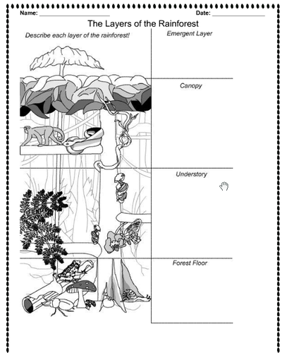
A whole lesson for the Layers of the Rainforest, with lesson plan, success criteria, notebook file and worksheet. Taught to Year 2 and 3 mixed.
ks1 ks2 y1 y2 y3 y4 y5 y6